| Date: | 1857 |
|---|---|
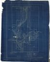
| Description: | This map shows lot and block numbers, streets, railroad depots, locks, bridges, dams, canals, U.S. light house, college grounds, a steam boat landing, and ... |

| Date: | 1891 |
|---|---|
| Description: | This map shows soft marshland, water channels, solid ground, club boundary and shooting boxes. Big Lake, First Channel, Second Channel, Fout Mile Pond, Mal... |

| Date: | 1891 |
|---|---|
| Description: | This map shows soft marshland, water channels, solid ground, club boundary and shooting boxes. Big Lake, First Channel, Second Channel, Fout Mile Pond, Mal... |

| Date: | 1878 |
|---|---|
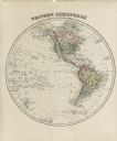
| Description: | This lithograph shows Greenland, North America, Central America, South America, Polynesia, Australia, the Pacific Ocean, the Atlantic Ocean, the Arctic Oce... |

| Date: | 1878 |
|---|---|
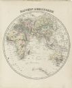
| Description: | This lithograph shows Africa, Europe, Asia, Australia, and the Antarctic Continent, the Atlantic Ocean, the Indian Ocean, the Arctic Ocean, the Pacific Oce... |

| Date: | 1871 |
|---|---|
| Description: | A map of California showing railroad lines and reservations. |

| Date: | 1853 |
|---|---|
| Description: | A map of Wellfleet Harbor on Cape Cod Bay. |

| Date: | 1846 |
|---|---|
| Description: | Chart of Green Bay showing depths and locations of numerous islands at a scale of 1 inch to 2 miles. There is also a profile of the dividing ridge at Sturg... |

| Date: | 1814 |
|---|---|
| Description: | A map of the Harbour (sic) of St. Catherine (Brazil). |
If you didn't find the material you searched for, our Library Reference Staff can help.
Call our reference desk at 608-264-6535 or email us at: