| Date: | 1952 |
|---|---|
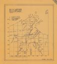
| Description: | This map of the northern parts of the Chequamegon Bay area in Bayfield and Ashland counties, Wisconsin, shows trails, roads, railroads, stations, the towns... |

| Date: | 1950 |
|---|---|
| Description: | This map is intended for tourists visiting La Crosse. The front of the map provides extensive text on attractions and activities in La Crosse while the bac... |

| Date: | 1959 |
|---|---|
| Description: | This map includes directories, illustrations, and an inset location map and also covers Rock, Hog, Detroit and Plum islands. |
If you didn't find the material you searched for, our Library Reference Staff can help.
Call our reference desk at 608-264-6535 or email us at: