 Filter: Categories of Wisconsin Historical Images
Filter: Subject of Land
Filter: Creator Name of Wisconsin. Department of Natural Resources.
Filter: Categories of Wisconsin Historical Images
Filter: Subject of Land
Filter: Creator Name of Wisconsin. Department of Natural Resources.
| Date: | 08 1976 |
|---|---|
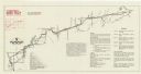
| Description: | A map that shows the trail route and detours from Rice Lake, in Barron County, through Washburn and Sawyer counties, to Park Falls, in Price County. A mile... |
| Date: | |
|---|---|
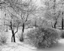
| Description: | View of a forest clearing, with snow covering the ground and branches of trees and shrubs. Footprints or animal tracks are in the snow. |
If you didn't find the material you searched for, our Library Reference Staff can help.
Call our reference desk at 608-264-6535 or email us at: