 Filter: Categories of Wisconsin Historical Images
Filter: Subject of Land
Filter: County of Green
Filter: Categories of Wisconsin Historical Images
Filter: Subject of Land
Filter: County of Green
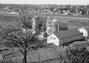
| Date: | 05 27 1961 |
|---|---|
| Description: | A view overlooking the edge of the town, taken from an eastern slope, with a farm and cows in the foreground. |
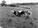
| Date: | 08 1929 |
|---|---|
| Description: | Young dairy cows feeding in a clover pasture with farm buildings in the background. |

| Date: | 1871 |
|---|---|
| Description: | Birds eye map of Monroe, WI, depicts street names and street locations, houses, and trees. A reference key at the bottom of the map shows the locations of ... |

| Date: | 1860 |
|---|---|
| Description: | Bird's-eye drawing of New Glarus. |
| Date: | 1877 |
|---|---|
| Description: | View from hill down the unpaved main street. There is a man and two women standing in front of a fence and house across the street on the right. |
| Date: | 1874 |
|---|---|
| Description: | View of New Glarus from a neighboring hill. A man, wearing a hat and suit, and five children, girls and boys, are posing along the fence in the foreground.... |
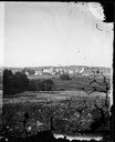
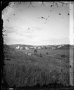
| Date: | 1874 |
|---|---|
| Description: | View, from a distance, of New Glarus. A hill, trees and fences are in the foreground. |
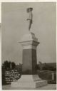
| Date: | 1915 |
|---|---|
| Description: | Monument to the first settlers in this Swiss colony, 1845. |
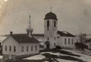
| Date: | 1895 |
|---|---|
| Description: | Slightly elevated view of the Swiss Reformed Church, destroyed in 1899. Snow is on the ground. |

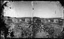
| Date: | 1910 |
|---|---|
| Description: | Elevated view from hill looking down at houses below. |

| Date: | 1898 |
|---|---|
| Description: | Exterior view of the Zwingli Reformed Church. |
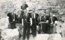
| Date: | |
|---|---|
| Description: | Outdoor group portrait of a group of Swiss yodelers in costume. The gentleman in the center has a distinctive moustache. |
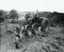
| Date: | 06 05 1944 |
|---|---|
| Description: | Paul F. Klassy uses a Farmall M tractor with a Number 15 Genius tractor plow to work in a field. |
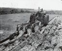
| Date: | 06 05 1944 |
|---|---|
| Description: | G.F. Klassy operates a McCormick-Deering Farmall M with a Number 15 Genius tractor plow on his farm on Route 1. |
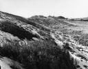
| Date: | 01 1981 |
|---|---|
| Description: | Empty snowy plains soon to be turned into Rt. 81. Hills and a few poles are in the far distance. |
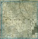
| Date: | 1861 |
|---|---|
| Description: | A detail from a map of Green County, showing only Decatur. |

| Date: | 06 13 |
|---|---|
| Description: | Photographic postcard of the Sugar River. Elevated view of buildings and trees lining the shoreline. Two men can be seen standing next to the dam among a p... |
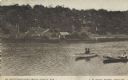
| Date: | 01 02 1909 |
|---|---|
| Description: | Photographic postcard view across water towards a tree-covered shoreline near Dr. Whitcomb's Sanitarium. Two men are sitting in a rowboat near another man ... |
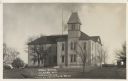
| Date: | 1908 |
|---|---|
| Description: | Photographic postcard view of the exterior of the high school. Front view of the school includes a flag pole and bare trees on the lawn surrounding the sch... |

| Date: | |
|---|---|
| Description: | View uphill of a log house with a "Davis Junction" sign on the porch. |
If you didn't find the material you searched for, our Library Reference Staff can help.
Call our reference desk at 608-264-6535 or email us at: