| Date: | 1891 |
|---|---|
| Description: | This blueprint manuscript map shows land owned by Green Bay & Mississippi Canal Co., Meade, Vilas, Patten, and Hewitt. Streets and the Fox River are labele... |

| Date: | 1912 |
|---|---|
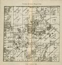
| Description: | Marinette County, Township 36 N., Range 19 E. |

| Date: | 1912 |
|---|---|
| Description: | Marinette plat map, Township 37 N., Range 19 E. |

| Date: | 1912 |
|---|---|
| Description: | Marinette County, Township 36 N., Range 20 E. |

| Date: | 1912 |
|---|---|
| Description: | Marinette County, Township 37 N., Range 20 E. |

| Date: | 1912 |
|---|---|
| Description: | Marinette County, Fract. Township 36 N., Ranges 21 and 22 E. |

| Date: | 1912 |
|---|---|
| Description: | Marinette County, Fract. Township 37 N., Ranges 21 and 22 E. |

| Date: | 1912 |
|---|---|
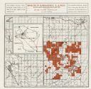
| Description: | This map shows land for sale by the Rusk Farm Company. Caption reads, "Look carefully at the map. Notice the thickly settled country on all sides of our la... |

| Date: | 1910 |
|---|---|
| Description: | This map of shows railway lines in red, with railroad land grant in Taylor, Price, and Ashland Counties shaded red, on top of the cities, counties, highway... |

| Date: | 1790 |
|---|---|
| Description: | An ink and hand-colored map, showing the land and landowners of the Susquehanna company purchase in Pennsylvania. Rivers are shown and occasionally labeled... |

| Date: | 1902 |
|---|---|
| Description: | A plat map of Lincoln County showing Township 34 North, Range 8 East. |

| Date: | |
|---|---|
| Description: | A photocopy of the T.34N, R.8E portion of a map of Lincoln County. |

| Date: | 1972 |
|---|---|
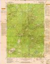
| Description: | A topographic map of the Blackwell quadrangle. |

| Date: | 1901 |
|---|---|
| Description: | A plat map of Marathon county, 28 township, north range, 7 east. |

| Date: | 1901 |
|---|---|
| Description: | A plat map of Marathon county, township 28, north range, 8 east. |

| Date: | 1910 |
|---|---|
| Description: | A land ownership map of the township of Leroy. |

| Date: | 1857 |
|---|---|
| Description: | Green Lake County Abstract plat map, T. 14 N, R. 11 E. |
If you didn't find the material you searched for, our Library Reference Staff can help.
Call our reference desk at 608-264-6535 or email us at: