 Filter: Categories of Wisconsin Historical Images
Filter: Subject of Maps
Filter: Type of Map or Atlas
Filter: Year of 1900-1999
Filter: Year of 1900-1909
Filter: Categories of Wisconsin Historical Images
Filter: Subject of Maps
Filter: Type of Map or Atlas
Filter: Year of 1900-1999
Filter: Year of 1900-1909

| Date: | 1904 |
|---|---|
| Description: | A map showing the design for a park fronting on Lake Monona Bay. (Now called Brittingham Park) taken from between pages 44 & 45 of the 1905 Madison Park a... |
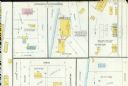
| Date: | 03 1904 |
|---|---|
| Description: | Detail of a Sanborn map of Grafton including the Sheboygan Knitting Company. |
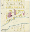
| Date: | 1907 |
|---|---|
| Description: | A Sanborn map of Green Bay, prominently featuring the East River. |

| Date: | 1902 |
|---|---|
| Description: | This map shows townships, land parcels, schools, rivers, lakes, creameries, churches, cemeteries, roads, post offices, town halls, saw mills, roads and sto... |

| Date: | 1906 |
|---|---|
| Description: | This map shows the cities, counties (outlined in yellow and labeled), rivers, lakes, and the major highways and freeways of Wisconsin and parts of the surr... |
| Date: | 1900 |
|---|---|
| Description: | This photocopy map shows the village in sections 23 and 24 of T19, R23E; later this area became part of the city of Manitowoc. The back of the map includes... |
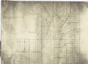
| Date: | 1900 |
|---|---|
| Description: | This facsimile of manuscript map shows lot numbers, dimensions, streets, and township lines. The bottom left corner includes a certification. |
| Date: | 1900 |
|---|---|
| Description: | This facsimile of a manuscript map shows lots and streets. The lower left corner includes a certification. |

| Date: | 1900 |
|---|---|
| Description: | This photocopy plat map of a paper city on the southeastern shore of Green Bay, probably in Brown County. The front includes a registration and the back in... |

| Date: | 1900 |
|---|---|
| Description: | This manuscript map shows outline of Fort Winnebago reserve land, Fort Winnebago, claim of A. Grignon, and Indian boundaries. The Fox River and Swan Lake a... |
If you didn't find the material you searched for, our Library Reference Staff can help.
Call our reference desk at 608-264-6535 or email us at: