 Filter: Categories of Wisconsin Historical Images
Filter: Subject of Ocean
Filter: Subject of land
Filter: Categories of Wisconsin Historical Images
Filter: Subject of Ocean
Filter: Subject of land

| Date: | |
|---|---|
| Description: | Elevated view toward a dwelling that overlooks a steep rocky shoreline over the ocean below. Several people walk along the sand. |

| Date: | |
|---|---|
| Description: | Elevated view of Bermuda shoreline. Several dwellings stand on top of the island and people swim in the ocean on the beaches below. |

| Date: | |
|---|---|
| Description: | People stand and sit on a driftwood-cluttered beach. Several people swim in the ocean. Caption reads: "Scene on the Beach. Long Beach. Wash." |

| Date: | |
|---|---|
| Description: | Bird's-eye view lithograph of Key West with ships and smaller boats in the surrounding waters. |

| Date: | 1959 |
|---|---|
| Description: | Aerial view of the island of Cuba taken from a small plane. Part of the plane with a Cuban flag painted on it is in the frame, and the island with many bui... |

| Date: | 1945 |
|---|---|
| Description: | Leota Kelly, directer of the Pacific Athletic Club, division of the Red Cross, and colleagues, at the site of the new Red Cross Club in Tinian near a cliff... |

| Date: | 1945 |
|---|---|
| Description: | Leota Kelly, director of the Red Cross's Pacific Athletic Club, posing for a picture by the shore in Tinian at the site of the new Red Cross Club. Kelly is... |

| Date: | |
|---|---|
| Description: | View of expansive gardens rolling down to a harbor. |

| Date: | |
|---|---|
| Description: | View from the terrace at the Walhall Estate. The shoreline can be seen past a stone fence and the lawn. |
| Date: | |
|---|---|
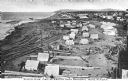
| Description: | Elevated view of an Eskimo tent village on sandspit along the shoreline. Wood buildings are along higher ground on the right near a river. |

| Date: | 1861 |
|---|---|
| Description: | A general map of Pennsylvania, Virginia, New Jersey and Delaware. Insets include maps of New Orleans, Baltimore, St. Louis, Charleston, Savannah, Washingto... |

| Date: | 1865 |
|---|---|
| Description: | This map of Maryland and Virginia shows railroads, rivers, cities and towns, and the positions of Confederate troops and defenses in Virginia in 1861. |

| Date: | 1860 |
|---|---|
| Description: | This colored map shows railroad lines east of the Mississippi as well as in the states bordering the Mississippi River. The Great Lakes and Gulf of Mexico ... |

| Date: | 1778 |
|---|---|
| Description: | This Italian map from 1778 depicts the upper portion of the Old Northwest. Rivers and lakes are identified and relief, real and imagined, is depicted picto... |

| Date: | 1862 |
|---|---|
| Description: | This map of the southeastern United States shows cities and towns, rail lines, and geographic features such as rivers, mountains, lakes, and swamps. |

| Date: | 1862 |
|---|---|
| Description: | This map of the southeastern United States shows forts and battlefields, railroads, rivers, and cities and towns. Dates of admission and secession of the s... |

| Date: | 1863 |
|---|---|
| Description: | A general map of the southeastern United States showing Missouri, Kentucky, West Virginia, Virginia, North Carolina, South Carolina, Georgia, Florida, Alab... |
| Date: | |
|---|---|
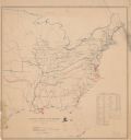
| Description: | Map of the eastern United States that illustrates the limits of the "loyal states" as of July 1861 in red, the territory controlled by United States forces... |

| Date: | 1899 |
|---|---|
| Description: | A map showing the shoreline of a portion of El Montecito, Santa Barbara County, California. The map shows properties along the Pacific Ocean, and may have ... |
If you didn't find the material you searched for, our Library Reference Staff can help.
Call our reference desk at 608-264-6535 or email us at:
