Filter: Categories of Wisconsin Historical Images
Filter: Subject of Piers
Filter: County of Bayfield
Filter: Community of Washburn
Filter: Subject of cities and towns
Filter: Categories of Wisconsin Historical Images
Filter: Subject of Piers
Filter: County of Bayfield
Filter: Community of Washburn
Filter: Subject of cities and towns

| Date: | 1886 |
|---|---|
| Description: | Bird's-eye map of Washburn on Lake Superior. There is an inset of Washburn, Chequamagon and the Apostle Islands. |

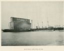
| Date: | 1896 |
|---|---|
| Description: | Bird's-eye view of Washburn, with twenty vignettes around side, water in foreground with docks and lumber corral. Thirty-three locations identified in key ... |
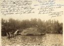
| Date: | 1904 |
|---|---|
| Description: | View across water towards Brower Park near Houghton Point. |
If you didn't find the material you searched for, our Library Reference Staff can help.
Call our reference desk at 608-264-6535 or email us at: