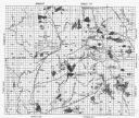
| Date: | 1874 |
|---|---|
| Description: | Bird's-eye map of Chippewa Falls. |

| Date: | |
|---|---|
| Description: | Page from the brochure entitled "Gold Fish Pond." |

| Date: | |
|---|---|
| Description: | Two views of the Prairie Dells dam site including the pond, the falls and the power house. |

| Date: | |
|---|---|
| Description: | A bridge leads across a body of water to the three-story Smith's (Resort) Hotel. Several people stand on the building's wrap-around porch and the roof feat... |

| Date: | 1900 |
|---|---|
| Description: | This map shows logging roads, railroads with spur lines, trails, rapids, lumber camps, Indian villages, summer resort, lakes, rivers, and ponds. |
If you didn't find the material you searched for, our Library Reference Staff can help.
Call our reference desk at 608-264-6535 or email us at: