| Date: | 1900 |
|---|---|
| Description: | This map shows the additions made in January 1855, as well as houses, streets, Catfish Creek, and the Milwaukee and Mississippi Rail Road and Depot. It als... |

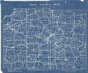
| Date: | 1927 |
|---|---|
| Description: | This Blue line print map shows trade area boundaries, lakes, farm homes, railways, high schools, public highways, and townships. A symbol key is included i... |

| Date: | 1921 |
|---|---|
| Description: | This map, oriented with north to the upper right, shows roads, railroads, and points of interest. Lake Mendota, Wingra, Monona, Waubesa, Mud, Hook, Island,... |

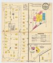
| Date: | 12 1912 |
|---|---|
| Description: | Sanborn map of Sun Prairie, which includes an index and information about water facilities and the fire department. Includes a small inset map of the State... |

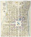
| Date: | 1908 |
|---|---|
| Description: | A Sanborn map featuring the Capitol Square and surrounding business district. |

| Date: | 06 1960 |
|---|---|
| Description: | Aerial view looking northwest showing an area to be redeveloped into high-rise dormitories. Lake Mendota and Bascom Woods can be seen at the top. Universit... |

| Date: | 1967 |
|---|---|
| Description: | Air view looking north toward Lake Mendota. The intersection of West Washington Ave. and S. Park Street is at bottom center. The Triangle Redevelopment Pro... |

| Date: | 05 01 1957 |
|---|---|
| Description: | Madison Schools students chosen as Safety Patrol members by their schools board the train to Washington, D.C. to attend the National Assembly of School Saf... |

| Date: | 1908 |
|---|---|
| Description: | Bird's-eye view showing Lake Mendota, Lake Monona, Lake Waubesa, Lake Wingra and Lake Kegonsa. Madison has only the isthmus developed, and there are settle... |

| Date: | 1928 |
|---|---|
| Description: | Birds-eye view showing Lake Mendota, Lake Monona, Lake Wingra, Lake Waubesa and Lake Kegonsa. Shows the growth of Madison from the Isthmus along the southe... |

| Date: | 08 01 1957 |
|---|---|
| Description: | North Western Railroad employees attempt to demolish a concrete coal chute at the railroad's East Side yard at Commercial and Sherman Avenues. Groups of me... |

| Date: | 08 01 1957 |
|---|---|
| Description: | North Western Railroad employees attempt to demolish a concrete coal chute at the railroad's East Side yard at Commercial and Sherman Avenue. The first att... |

| Date: | 08 01 1957 |
|---|---|
| Description: | North Western Railroad employees attempt to demolish a concrete coal chute at the railroad's East Side yard at Commercial and Sherman Avenues. After the du... |

| Date: | 08 02 1957 |
|---|---|
| Description: | North Western Railroad employees demolish a concrete coal chute at the railroad's East Side yard, at Commercial and Sherman Avenues, on their second attemp... |

| Date: | 05 19 1959 |
|---|---|
| Description: | Henry Cuccia, a ninth-grader at Cherokee Heights school, demonstrates "what not to do" on the Illinois Central railroad tracks near the school as he walks ... |

| Date: | 05 19 1959 |
|---|---|
| Description: | John and Jane Pike, who live near the Illinois Central railroad tracks, demonstrate for the photographer what they have been told not to do — put stones on... |

| Date: | 05 19 1959 |
|---|---|
| Description: | Kathy Cramer, an eighth-grader at Cherkokee Heights school demonstrates "what not to do" on the Illinois Central railroad tracks near the school by crossin... |

| Date: | 01 05 1914 |
|---|---|
| Description: | Text on front reads: "C. & N. W. Station, Madison, Wis." The Chicago and North Western Railroad Station, located on South Blair Street. There are pedestria... |

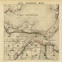
| Date: | 1924 |
|---|---|
| Description: | A map of the Madison Township, T7N R9E including Lake Mendota showing the location of Ho Chunk encampments and effigy mounds. |
If you didn't find the material you searched for, our Library Reference Staff can help.
Call our reference desk at 608-264-6535 or email us at: