
| Date: | 1955 |
|---|---|
| Description: | This 1950s tourist brochure features a map of Burnett County, Wisconsin, and northern Polk County which shows highways and roads, railroads, landmarks, and... |

| Date: | 1991 |
|---|---|
| Description: | This 1991 map of Burnett County, Wisconsin, shows Governor Knowles State Forest, wildlife areas, public hunting grounds, and other outdoor recreation facil... |

| Date: | 1938 |
|---|---|
| Description: | This tourist map of Door County, Wisconsin, lists the points of interest and resorts in the area. An inset location map is included. |

| Date: | 1938 |
|---|---|
| Description: | This 1938 tourist map of Douglas County, Wisconsin, identifies game refuges, fishing locations, and other outdoor recreation opportunities in the county. A... |
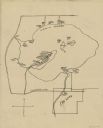
| Date: | 1930 |
|---|---|
| Description: | This manuscript map, likely drawn in the 1930s, shows Fox Lake, in Dodge County, Wisconsin, and the roads and resorts in the vicinity. |

| Date: | 1940 |
|---|---|
| Description: | Map shows hydrography and location of game fish in part of Vilas County, Wisconsin and Gogebic County, Michigan. |

| Date: | 1909 |
|---|---|
| Description: | This 1909 map of northern Wisconsin and a portion of Michigan's Upper Peninsula shows the Lac du Flambeau Indian Reservation, cities and villages, railroad... |
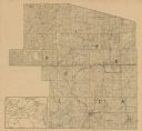
| Date: | 1953 |
|---|---|
| Description: | This mid 20th century map of Vilas County and northeastern Oneida County, Wisconsin, shows the township and range grid, sections, cities and villages, rail... |

| Date: | 1925 |
|---|---|
| Description: | Shows buildings, piers, winter and summer levels, and resort lands. Depths shown by isolines. Relief shown by contours. From the E.P. Sherry papers relatin... |

| Date: | 1938 |
|---|---|
| Description: | The map includes text, illustrations, a railroad fare table (season 1938), a Directory of resorts and hotels, and a regional map on the back. |

| Date: | 1956 |
|---|---|
| Description: | This map shows Lake Wisconsin, roads, highways, parks, resort areas, camps, gardens, and Wisconsin State experimental game and fur farm. The back of the ma... |
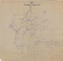
| Date: | 1941 |
|---|---|
| Description: | This is map one of three maps that show trails, roads and fire lanes, utilities, resorts, submerged lakes, vegetation, flowage right lands, and timber righ... |

| Date: | 1938 |
|---|---|
| Description: | This map shows lakes, lodges and resorts, roads, and railroads in Sherman township and a portion of Mercer township. Points of interest are marked with a s... |

| Date: | 1853 |
|---|---|
| Description: | This map shows camps, forts, logging camps, lakes, roads, railroads, the Wisconsin River, and Lac Du Flambeau Indian Reservation. Some points of interest a... |

| Date: | 1930 |
|---|---|
| Description: | Original map made with watercolor and inkwash. Includes a legend of buildings, roads, natural features and other details of the lodge. Inset at bottom has ... |
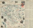
| Date: | 1926 |
|---|---|
| Description: | This brochure was intended for tourists and shows resorts, lakes and railroads in northwestern Wisconsin and part of Michigan’s upper peninsula. Also inclu... |
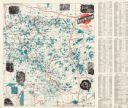
| Date: | 1939 |
|---|---|
| Description: | This brochure was intended for tourists and shows resorts, lakes and railroads in northwestern Wisconsin and part of Michigan’s upper peninsula. Also inclu... |
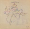
| Date: | 1941 |
|---|---|
| Description: | This is map three of a set of three, and shows trails, roads and fire lanes, utilities, resorts, submerged lakes, vegetation, flowage right lands, and timb... |

| Date: | 1910 |
|---|---|
| Description: | This map shows shoreline lot numbers and acreages, the Wisconsin River, and the Michigan and Wisconsin state line. Manuscript annotations relating to topon... |

| Date: | 1952 |
|---|---|
| Description: | This map shows roads, foot and canoe trails, railroads, resorts, lookout towers, camps, national and state forests, Indian reservation, and types of fish i... |
If you didn't find the material you searched for, our Library Reference Staff can help.
Call our reference desk at 608-264-6535 or email us at: