 Filter: Categories of Wisconsin Historical Images
Filter: Subject of Rivers
Filter: Year of 1900-1999
Filter: Community of Appleton
Filter: Categories of Wisconsin Historical Images
Filter: Subject of Rivers
Filter: Year of 1900-1999
Filter: Community of Appleton

| Date: | 1960 |
|---|---|
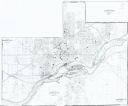
| Description: | This map shows local streets, wards, public buildings, parks, and part of the Fox River. The land is shown in white and the water is shown in blue. The map... |
| Date: | 1949 |
|---|---|
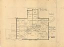
| Description: | This map is ink and pencil on paper and shows land ownership by name, years of purchase, and city limits. Also included on the right and bottom margins are... |
| Date: | 1985 |
|---|---|
| Description: | This photocopied map shows the area as it appeared in 1889. The map shows buildings, lot numbers, some landownership, and the Fox River. |
| Date: | 01 1950 |
|---|---|
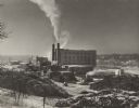
| Description: | Winter image of the Interlake Pulp Mill in the Fox River Valley. The buildings are surrounded by large stacks of logs. The Fox River can be seen behind and... |
| Date: | 02 1951 |
|---|---|
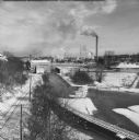
| Description: | Elevated view of the Fox River Valley from Memorial Drive bridge, looking East. Snow is on the ground, ice is on the river and the smokestacks are billowin... |

| Date: | 1963 |
|---|---|
| Description: | Elevated view from East College Avenue bridge of motor boats exiting Lock #4 on the Upper Fox River. |
If you didn't find the material you searched for, our Library Reference Staff can help.
Call our reference desk at 608-264-6535 or email us at: