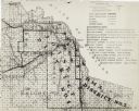
| Date: | 1930 |
|---|---|
| Description: | This map shows schools, school districts, town sections, highways, railroads, and hydrography of the area around Hurley. The right margin includes and expl... |

| Date: | 1905 |
|---|---|
| Description: | Slightly elevated view of the border between Hurley, WI and Ironwood, MI. Caption reads: "Looking east from Hurley side of Montreal River near Silver Stree... |
If you didn't find the material you searched for, our Library Reference Staff can help.
Call our reference desk at 608-264-6535 or email us at: