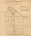
| Date: | 1939 |
|---|---|
| Description: | This map shows the towns to Gingles, Sanborn, and Guney as well as Chequamegon Bay, Kakagon River, White River, Marengo River, Bad River, Potato River, Vau... |

| Date: | 1911 |
|---|---|
| Description: | This map shows swamps, railroads, rivers, roads, the Catholic Mission Reserve, the day school, and the Agency Reserve. Lake Superior is labeled. An inset m... |

| Date: | 1954 |
|---|---|
| Description: | This map shows the location of Catholic churches, missions, and shrines. The map is color coded and includes a key in the bottom left corner. The back of t... |
If you didn't find the material you searched for, our Library Reference Staff can help.
Call our reference desk at 608-264-6535 or email us at: