Filter: Categories of Wisconsin Historical Images
Filter: Subject of Rivers
Filter: Year of 1900-1999
Filter: Year of 1910-1919
Filter: Type of Map or Atlas
Filter: Categories of Wisconsin Historical Images
Filter: Subject of Rivers
Filter: Year of 1900-1999
Filter: Year of 1910-1919
Filter: Type of Map or Atlas

| Date: | 1910 |
|---|---|
| Description: | Map of Dane County rural delivery in Madison and the town of Westport. |

| Date: | 1910 |
|---|---|
| Description: | Map of the general plan of the district of the Four Lakes. |

| Date: | 1913 |
|---|---|
| Description: | Bird's-eye map of Superior. "The New Steel Center." |

| Date: | 1915 |
|---|---|
| Description: | Bird's-eye view of Superior, Wisconsin, and Duluth, Minnesota on opposite shore of Lake Superior. |

| Date: | 1914 |
|---|---|
| Description: | This map shows Sheboygan in 1914. The top of the map has the date of "NOV 17 1916" stamped in red ink. The map shows numbered plots and labeled streets, an... |

| Date: | 1918 |
|---|---|
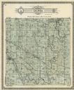
| Description: | Page from the Standard Atlas of Grant County, Wisconsin of Part of Townships 5 and 6 North, Range 5 West of the 4th P.M. |

| Date: | 1911 |
|---|---|
| Description: | Plat Map of Blooming Grove in "Atlas of Dane County, Wisconsin." |

| Date: | 1910 |
|---|---|
| Description: | Wisconsin Geological and Natural History Survey, by Lawrence Martin reproduced from a model of the state prepared by W.O. Hotchkiss and F.T. Thwaites and m... |

| Date: | 1910 |
|---|---|
| Description: | Scale: 1:62500. Topography by Robert Muldrow. Surveyed in 1904. Edition of Aug. 1906, reprinted in 1910. |

| Date: | 1916 |
|---|---|
| Description: | Southeastern Wisconsin which lies east of Whitewater and south of Port Washington. |

| Date: | 1913 |
|---|---|
| Description: | Shows lands in green owned and for sale by Homeseekers Land Company, H.J. McKusick, Secretary. Map, part colored. No scale. Photographs on reverse of origi... |

| Date: | 1913 |
|---|---|
| Description: | Wisconsin map showing fifteen hundred miles of national highways proposed by the National Highways Association. Scale: 1:2,500,000. These highways will dir... |

| Date: | 1919 |
|---|---|
| Description: | This is a collection of three hand-colored plat maps. One map is a plat plan and includes annotations and an index that shows public land, business, indust... |

| Date: | 1912 |
|---|---|
| Description: | Sanborn insurance map of the main street in Potosi, Wisconsin, with an inset for the Potosi Brewery. |

| Date: | 1915 |
|---|---|
| Description: | Plat map of Polk township in Washington County. |

| Date: | 1910 |
|---|---|
| Description: | The right half of a plat map of Hustisford in Dodge County. |
If you didn't find the material you searched for, our Library Reference Staff can help.
Call our reference desk at 608-264-6535 or email us at: