 Filter: Categories of Wisconsin Historical Images
Filter: Subject of Rivers
Filter: Year of 1900-1999
Filter: Year of 1940-1949
Filter: Categories of Wisconsin Historical Images
Filter: Subject of Rivers
Filter: Year of 1900-1999
Filter: Year of 1940-1949

| Date: | 1948 |
|---|---|
| Description: | Prior to the 1948 State Fair, artist Robert Hodgell traveled Wisconsin to study its many landscapes. He then produced a series of study sketches outlining ... |

| Date: | 1941 |
|---|---|
| Description: | A tourist map of Marinette County, Wisconsin that includes indexes of the lakes and rivers in the county which also identify the fish present, a list of ra... |

| Date: | 1941 |
|---|---|
| Description: | A pictorial map of Lake Mendota that shows Indian sites and legends associated with the Lake and its surrounding area. Some of those mentioned on the map i... |

| Date: | 1940 |
|---|---|
| Description: | Map of Milwaukee County showing the metropolitan area, in yellow, and the proposed connecting of parkways and boulevards in green. The map also identifies ... |

| Date: | 1940 |
|---|---|
| Description: | A map of Milwaukee County, showing the route of the county tour of Milwaukee in the dark line, as well as identifying other roads, streets, and the Root, M... |

| Date: | 11 14 1942 |
|---|---|
| Description: | This pictorial map illustrates Potawatomi Indian legends from the region of Lower Phantom Lake, labeled Howitt Lake on the map, Phantom Lake, and Mukwonag... |

| Date: | 1949 |
|---|---|
| Description: | This 1949 map shows the topography and significant landmarks in Copper Falls State Park, Ashland County, Wisconsin. |

| Date: | 1941 |
|---|---|
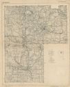
| Description: | This 1941 map covers Washburn County, Wisconsin, as well as western Sawyer, eastern Burnett, and northeastern Polk counties. It shows the locations of tour... |

| Date: | 1947 |
|---|---|
| Description: | Shows lot and block numbers, 28 points of interest in the upper left that correspond to numbers on the map, and landownership with acreages. "Erickson Brot... |

| Date: | 1940 |
|---|---|
| Description: | This map is pen and ink on paper and is 1 map consisting of 12 sheets. This map includes a numbered key labeling each area, all of which are represented ... |

| Date: | 1940 |
|---|---|
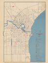
| Description: | Shows Milwaukee and Waukesha counties, and parts of Dodge, Washington, Ozaukee, Jefferson, Walworth, and Racine counties. Includes indexes of "Cities, Town... |
| Date: | 1941 |
|---|---|
| Description: | This map covers the area of Lincoln and Oneida counties, and part of Marathon county and includes a location map and legend. The bottom left margin reads: ... |
| Date: | 1945 |
|---|---|
| Description: | Map features a legend with symbols of points of interest. The symbols are in red. The back of the map has text on "Points of Interest and Information". |
| Date: | 01 18 1944 |
|---|---|
| Description: | Three soldiers view an old damaged indigenous suspension bridge. The soldier with a rifle on the right is Private Marion Tewalt of Viroqua, Wisconsin. The ... |

| Date: | 1947 |
|---|---|
| Description: | Lower left hand corner features a legend. "Drawn 1938, revised 1947." Shows water mains, hydrants, corporation limits, city ward divisions, fire proof buil... |

| Date: | 1943 |
|---|---|
| Description: | Soldiers in battle gear, holding rifles, marching in a long line across a wooden bridge. Across the water is a building on the shoreline with the jungle be... |
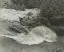
| Date: | 1944 |
|---|---|
| Description: | Elevated view of a tank fording a river. Two soldiers are standing in the hatches on the gun turret, with another soldier in a partially opened hatch below... |

| Date: | 10 13 1943 |
|---|---|
| Description: | Aerial view of two Consolidated B-24 Liberator warplanes taken from another airplane during the Alexishafen strike. On the left is Colonel Arthur Rogers' l... |

| Date: | 01 1940 |
|---|---|
| Description: | Map shows roads, railroads, the Fox River, parks, schools, and cemeteries and is indexed by street name in the margins. The bottom of the map show the Winn... |

| Date: | 1940 |
|---|---|
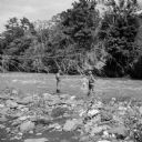
| Description: | Woman seated on flat rocks, watching rushing water of the Wolf River. |
If you didn't find the material you searched for, our Library Reference Staff can help.
Call our reference desk at 608-264-6535 or email us at: