| Date: | 1892 |
|---|---|
| Description: | Color bird's-eye map of Wauwatosa, looking east toward Milwaukee and Lake Michigan. Predominantly green with cream colored roadways, with six land plots ow... |

| Date: | 1891 |
|---|---|
| Description: | Map of a proposed subdivision. Map reads: "United States Investment Association SUBDIVISION No. 1 In S.W. 1/4 Sec. 33, Town 8, Range 22 East. Is situated a... |

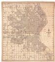
| Date: | 04 04 1934 |
|---|---|
| Description: | Street map of the city of Milwaukee and surrounding communities at a scale of 1 inch to 1200 feet. |

| Date: | 1906 |
|---|---|
| Description: | This map shows shows streets, subdivisions, railroads, places of interest including the State Capitol, the University of Wisconsin, Camp Randall, Henry Vil... |

| Date: | 1901 |
|---|---|
| Description: | This map shows public schools, engine houses, railroads, street railways, city wards, parks, block numbers, and Lake Michigan. Also included are indexes, t... |

| Date: | 1906 |
|---|---|
| Description: | This map shows wards, schools, engine houses, railroads, street railways, block numbers, parks, roads, and Lake Michigan. Also included are indexes: Table ... |

| Date: | 10 1911 |
|---|---|
| Description: | This map shows lot numbers, building lines, roads, trees, and Indian mounds. Relief is shown by contours. Includes manuscript annotations marking parks. |

| Date: | 1965 |
|---|---|
| Description: | This map shows landownership, acreages, and roads. The city of De Pere, the town of Hobart, and the Fox River are labeled. Inset maps showing Smits Subdivi... |

| Date: | 1934 |
|---|---|
| Description: | This road map contains automobile routes for the state of Wisconsin as well as portions of Minnesota, Illinois, Iowa and Michigan. Lake Michigan, Lake Sup... |
If you didn't find the material you searched for, our Library Reference Staff can help.
Call our reference desk at 608-264-6535 or email us at: