| Date: | 1854 |
|---|---|
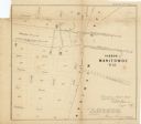
| Description: | This map shows streets, docks, warehouses, and piers near the harbor. Relief is shown by hachures and depths are shown by soundings and isolines. Lake Mich... |

| Date: | 10 1853 |
|---|---|
| Description: | This map shows warehouses and proposed extensions of piers. "Note: The soundings are in feet and tenths." The upper left margin reads: "Senate Ex. Doc. No.... |

| Date: | 10 1853 |
|---|---|
| Description: | This map shows warehouses and proposed extensions of piers. Also included are notes on soundings and the proposed extensions. The upper right margin reads:... |

| Date: | 12 1912 |
|---|---|
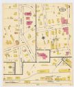
| Description: | Sanborn Map of Sun Prairie. The map highlights the public and parochial schools, the exhange, and church buildings, etc. |
If you didn't find the material you searched for, our Library Reference Staff can help.
Call our reference desk at 608-264-6535 or email us at: