 Filter: Categories of Wisconsin Historical Images
Filter: Subject of Water
Filter: Creator Name of Hathaway, Joshua, 1810-1863
Filter: Categories of Wisconsin Historical Images
Filter: Subject of Water
Filter: Creator Name of Hathaway, Joshua, 1810-1863
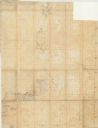
| Date: | 1852 |
|---|---|
| Description: | This manuscript map shows the portage of the Wisconsin and Fox rivers at Fort Winnebago, the course of the Fox River in Columbia and Marquette counties, an... |
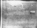
| Date: | 1900 |
|---|---|
| Description: | This map shows plots and streets as well at the Root River. The bottom margin and back of the map include extensive certifications. |
If you didn't find the material you searched for, our Library Reference Staff can help.
Call our reference desk at 608-264-6535 or email us at: