 Filter: Categories of Wisconsin Historical Images
Filter: Subject of Water
Filter: Creator Name of Wisconsin Geological and Natural History Survey
Filter: Subject of rivers
Filter: Categories of Wisconsin Historical Images
Filter: Subject of Water
Filter: Creator Name of Wisconsin Geological and Natural History Survey
Filter: Subject of rivers

| Date: | 1968 |
|---|---|
| Description: | This map shows lakes, rivers and soil types. Lake Michigan, Lake Superior, and portions of Illinois, Iowa, Michigan, and Minnesota are labeled. A legend to... |

| Date: | 1874 |
|---|---|
| Description: | This hand-colored map shows the railroads "completed" "in progress" and "contemplated" rivers, counties, cities and villages, and named towns in the state,... |

| Date: | 1926 |
|---|---|
| Description: | A topographic map of Green County, showing by contours and spot heights the topographic and natural features of the county. The contour intervals are 20 fe... |

| Date: | 1898 |
|---|---|
| Description: | Map showing the contour depths of the lakes in northwestern Waukesha County, Wisconsin. Roads, railroads, depots, churches, schools, and hotels in the area... |

| Date: | 1931 |
|---|---|
| Description: | Relief shown by contours and spot heights. Maps shows United States, state, county and local highways and roads, schools, North Bend, creeks, lakes, rivers... |
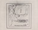
| Date: | 1928 |
|---|---|
| Description: | This map shows the junction between the Montreal River and the west branch of the Montreal River. The original captions on the map read: "Field Work by H.R... |
If you didn't find the material you searched for, our Library Reference Staff can help.
Call our reference desk at 608-264-6535 or email us at: