 Filter: Type of Map or Atlas
Filter: Creator Name of Beck and Pauli Litho
Filter: Subject of rivers
Filter: Type of Map or Atlas
Filter: Creator Name of Beck and Pauli Litho
Filter: Subject of rivers

| Date: | 1886 |
|---|---|
| Description: | Bird's-eye map of Hurley with insets Mining at the Colby, Hurley in 1885, and North Front of Silver Street. |

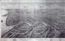
| Date: | 1891 |
|---|---|
| Description: | Bird's-eye view of Eau Claire. |

| Date: | 1879 |
|---|---|
| Description: | Bird's-eye map of Hartford. |

| Date: | 1885 |
|---|---|
| Description: | Bird's-eye map of Hustisford. |

| Date: | 1878 |
|---|---|
| Description: | Bird's-eye map of Kewaskum. Includes a list of hotels, churches, post office, railroad depot, etc. |

| Date: | 1879 |
|---|---|
| Description: | Bird's-eye map of Lake Mills. |

| Date: | 1883 |
|---|---|
| Description: | Bird's-eye map of Manitowoc. |
| Date: | 1879 |
|---|---|
| Description: | Bird's-eye map of Beaver Dam. |
If you didn't find the material you searched for, our Library Reference Staff can help.
Call our reference desk at 608-264-6535 or email us at:


