Filter: County of Dodge
Filter: Subject of land
Filter: Subject of cities and towns
Filter: County of Dodge
Filter: Subject of land
Filter: Subject of cities and towns

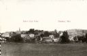
| Date: | 1885 |
|---|---|
| Description: | Bird's-eye map of Hustisford. |
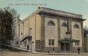
| Date: | 1912 |
|---|---|
| Description: | Exterior view of the Davison Theater. Caption reads: "Davison Theatre, Beaver Dam, Wis." |
| Date: | |
|---|---|
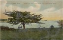
| Description: | Three people sitting on a bench under the old thorn apple tree at Schliewerts Island looking out at the lake. Caption reads: "Beaver Dam, Wis. Under the Ol... |
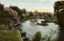
| Date: | 1905 |
|---|---|
| Description: | View from shoreline towards a river with a dam in the distance. Caption reads: "River Scene, Mayville, Wis." |
| Date: | |
|---|---|
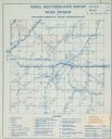
| Description: | Rural electrification map of Dodge county in Elba township. Title at top reads: "Rural Electrification Survey by Work Division of Wisconsin Emergency Relie... |

| Date: | 1910 |
|---|---|
| Description: | Left half of a plat map of Hustisford in Dodge County. |

| Date: | 1910 |
|---|---|
| Description: | The right half of a plat map of Hustisford in Dodge County. |
| Date: | 1909 |
|---|---|
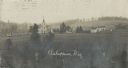
| Description: | Elevated view of a church with cemetery and farmhouses and rolling hills in the distance. Caption reads: "Ashippun, Wis." |
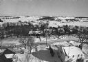
| Date: | 02 02 1978 |
|---|---|
| Description: | "Water tower view, looking due west." |
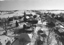
| Date: | 02 02 1978 |
|---|---|
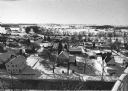
| Description: | "Groundhog Day... A view from the water tower, looking northwest. The 20mm lens provides a very wide angle of view." |
| Date: | 02 02 1978 |
|---|---|
| Description: | "Water tower view, looking to the east." |
| Date: | 02 02 1978 |
|---|---|
| Description: | "A view from the water tower, looking due south. Groundhog Day was a cloud-free day; forecasting six more weeks of bad weather." |
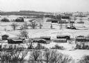
| Date: | 02 02 1978 |
|---|---|
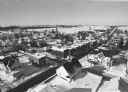
| Description: | "The camera looks to the new subdivision and beyond." |
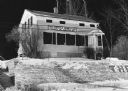
| Date: | 02 06 1978 |
|---|---|
| Description: | "Sol. Juneau's Homestead at night. In June, 1932, the house was moved to this location from its original site, higher up on the hill." Sign on residence re... |

| Date: | 02 16 1978 |
|---|---|
| Description: | "The long lens compresses this view from the frozen Rock River in the foreground, the Catholic cemetery, and the Haag farm buildings in the distance." |

| Date: | 02 1978 |
|---|---|
| Description: | Elevated view of the town's elaborate brick church featuring a central steeple. |
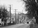
| Date: | 1948 |
|---|---|
| Description: | "Main (Milwaukee) Street. At this time Hwy 41 was still routed through the village." |
If you didn't find the material you searched for, our Library Reference Staff can help.
Call our reference desk at 608-264-6535 or email us at: