 Filter: Subject of Indians of North America
Filter: Type of Map or Atlas
Filter: Reproduction Rights of For Sale
Filter: Subject of Indians of North America
Filter: Type of Map or Atlas
Filter: Reproduction Rights of For Sale

| Date: | 1936 |
|---|---|
| Description: | This map is red and black ink on tracing cloth and is oriented with north to the upper left. This hand-drawn map shows a central portion of the military ro... |

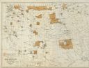
| Date: | 1886 |
|---|---|
| Description: | This map shows U.S. land offices, completed railroads, railroad land grant limits, lakes, rivers, and Indian reservations. Communities, lakes, and rivers a... |

| Date: | 1873 |
|---|---|
| Description: | Bird's-eye map of La Crosse from the Mississippi River. |

| Date: | 1655 |
|---|---|
| Description: | Map of Virginia Coast based on observations by Captain John Smith. |

| Date: | 1876 |
|---|---|
| Description: | A sketch map of the procession of Indian mounds on the two ridged field sites in Grant County. |
| Date: | 1882 |
|---|---|
| Description: | Map showing Indian Reservations in the United States. |

| Date: | 1877 |
|---|---|
| Description: | Map showing location of Indian reservations in the United States and population figures. |

| Date: | 1835 |
|---|---|
| Description: | Constructed for the Topographical Bureau [Wash.], 1835. Scale: 16 miles to 1 inch. Map of a portion of the Indian country lying east and west of the Missis... |

| Date: | 1857 |
|---|---|
| Description: | Information depicting the history, condition and prospects of the Indian tribes of the United States: collected and prepared under the direction of the Bur... |

| Date: | 1939 |
|---|---|
| Description: | A color, pictorial map. Scale: 10 miles to the inch. Shows state parks and forests, proposed state parkways, proposed state monuments and memorials, nation... |

| Date: | |
|---|---|
| Description: | Map reads: "Historic and Scenic Wisconsin — Land of Gathering Waters." In an inset there is a hand-painted depiction of the Wisconsin State Seal. For some ... |

| Date: | 1842 |
|---|---|
| Description: | Map reads: "Wisconsin". The map depicts the counties as of 1842 and the various areas of Indian settlements. The scale is twenty miles for every inch. |

| Date: | |
|---|---|
| Description: | Wisconsin Memorial Hospital with a key to buildings in the upper left. Indian mounds are marked on the site. Arthur Peabody was the state architect for th... |
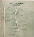
| Date: | 1893 |
|---|---|
| Description: | Plat map of Brothertown in Calumet County. |

| Date: | 1930 |
|---|---|
| Description: | Pictorial map of Glacier National Park, Montana and Waterton Lakes National Park, Alberta. Illustrated by Joe Scheurle, it depicts white people, American ... |

| Date: | |
|---|---|
| Description: | A hand-drawn map of Indian boundary lines in southwest Virginia. It also includes the Duck River and the Elk River. |

| Date: | 1952 |
|---|---|
| Description: | The famous Dells of the Wisconsin River. A souvenir map embellished with bits of history and points of interest. |

| Date: | 1886 |
|---|---|
| Description: | Wisconsin map showing land offices, railroads completed, railroad land grants and Indian reservations. |

| Date: | 1927 |
|---|---|
| Description: | Blueprint-style map of Frost Woods on the shore of Lake Monona. The map indicates the locations of Indian mounds, an Indian camp, and various plants. There... |
If you didn't find the material you searched for, our Library Reference Staff can help.
Call our reference desk at 608-264-6535 or email us at:
