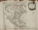
| Date: | 1760 |
|---|---|
| Description: | A map of the world in two hemispheres, with the borders of the continents hand-colored. This map contains 14 spherical diagrams of the cosmos, portraying t... |

| Date: | 1755 |
|---|---|
| Description: | This map shows the eastern half of North America during the French and Indian war, including cities, borders, Native American Land, forts, and detailed geo... |

| Date: | 1790 |
|---|---|
| Description: | An updated and corrected version of Robert de Vaugondy's 1750 map "Amérique Septentrionale: Dressée sur les Relations les Plus Modernes des Voyageurs et Na... |

| Date: | 1784 |
|---|---|
| Description: | Map showing fifty thousand acres of land in what will later become Kentucky, broken up into parcels labeled 1 through 50. No features are labeled, but the ... |
If you didn't find the material you searched for, our Library Reference Staff can help.
Call our reference desk at 608-264-6535 or email us at: