 Filter: Subject of advertising
Filter: Subject of rivers
Filter: Subject of advertising
Filter: Subject of rivers

| Date: | 1949 |
|---|---|
| Description: | This color map includes historical descriptions of select areas and a short article on the history of Wisconsin. The major highways in the state shown on t... |

| Date: | 1923 |
|---|---|
| Description: | This map shows trails, some in red, for automobiles. The right margin includes a key of markings as well as Minnesota and Wisconsin Highway signs. Communit... |

| Date: | 1937 |
|---|---|
| Description: | Label submitted to the state of Wisconsin for trademark registration. "Pioneer Beer, G. Weber Brewing Co." Under this in the center is a leaf with the lett... |
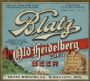
| Date: | 1933 |
|---|---|
| Description: | Label submitted to the state of Wisconsin for trademark registration. "Blatz, Old Heidelberg Castle, Beer, Blatz Brewing Co." Pictured on the label is a sc... |
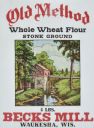
| Date: | 04 09 1935 |
|---|---|
| Description: | Label submitted to the State of Wisconsin for trademark registration. Features an illustration of a mill on a river. "Old Method, Whole Wheat Flour, Stone ... |

| Date: | 1904 |
|---|---|
| Description: | A brochure for the lake region of north-eastern Illinois and south-eastern Wisconsin providing information on summer activities and places to stay in the a... |

| Date: | 1931 |
|---|---|
| Description: | Page from an advertising brochure for International trucks. International trucks are used during the construction of an inter-county bridge between Columbi... |
| Date: | |
|---|---|
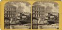
| Description: | View across the Milwaukee River, showing advertisements for the Riverside Printing House, Book and Job Printing, Spring Street Lager Beer Hall, and Hood an... |

| Date: | 1903 |
|---|---|
| Description: | This map of Richland County, Wisconsin, shows land ownership and acreages, the township and range grid, sections, cities, towns and post offices, roads, ra... |
| Date: | 1925 |
|---|---|
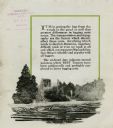
| Description: | Interior page of a pamphlet advertising the Best tractor for loggers. The text reads: "It is in getting the logs from the woods to the pond or mill that gr... |

| Date: | 1991 |
|---|---|
| Description: | This 1991 map of Burnett County, Wisconsin, shows Governor Knowles State Forest, wildlife areas, public hunting grounds, and other outdoor recreation facil... |

| Date: | 1970 |
|---|---|
| Description: | Elevated view of an International Harvester model MA-1500 Metro delivery truck is parked on a bridge overlooking a body of water and a city skyline, likely... |

| Date: | 1925 |
|---|---|
| Description: | Map produced by the Paul E. Stark Company to advertising sales and services. Bottom of the map features sales records for 1919 to 1925 and a paragraph read... |

| Date: | 1925 |
|---|---|
| Description: | Map produced by the Paul E. Stark Company to advertising sales and services. Bottom of the map features sales records for 1919 to 1925 and a paragraph read... |

| Date: | 1927 |
|---|---|
| Description: | Shows campus buildings, points of interest in surrounding area, and railroads. Advertisements on verso. |

| Date: | 1929 |
|---|---|
| Description: | This map is oriented with north to the upper right. Includes index of retailers and buildings, with some advertisements in margins. |

| Date: | |
|---|---|
| Description: | Group portrait of men and women, all wearing hats, peeking over the top of a large log along the riverbank. Other large logs are piled behind them. A railr... |
| Date: | 1971 |
|---|---|
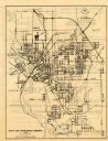
| Description: | This map of Stevens Point shows labeled streets and selected points of interest: "Holiday Inn," "Westernberger's Gifts," "Ralph L. Banke MLS Realtor," "Gol... |
| Date: | 1901 |
|---|---|
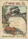
| Description: | Catalog cover with the title: "The Three Greatest Empires," features an illustration of an Empire Drill in the foreground, and in the background a train tr... |
| Date: | 1886 |
|---|---|
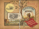
| Description: | Front and back cover of a catalog for harvesting machines. The cover features a color illustration of shocks of hay in a field surrounded by sun rays in th... |
If you didn't find the material you searched for, our Library Reference Staff can help.
Call our reference desk at 608-264-6535 or email us at: