 Filter: Subject of automobile driving
Filter: Subject of traffic signs and signals
Filter: Subject of service industries
Filter: Subject of automobile driving
Filter: Subject of traffic signs and signals
Filter: Subject of service industries

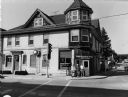
| Date: | |
|---|---|
| Description: | View down Strong's Avenue, taken from Clark Street. Automobiles park on either side of the street near storefronts. Perpendicular to Strongs Avenue is Main... |
| Date: | 06 08 2001 |
|---|---|
| Description: | "The Slinger House is at 100 W. Washington St. in Slinger, WI, at the intersection of Highway's 175 & 144." |

| Date: | 1920 |
|---|---|
| Description: | This early road map shows the system of roads in Wisconsin, northern Illinois, northeastern Iowa, southeastern Minnesota, and the western portion of Michig... |
If you didn't find the material you searched for, our Library Reference Staff can help.
Call our reference desk at 608-264-6535 or email us at: