| Date: | 06 1959 |
|---|---|
| Description: | Two men with cameras around their necks stand near a couple in a Plymouth pulling an airstream camper through a gate. The sign on the gate in the backgroun... |

| Date: | 1902 |
|---|---|
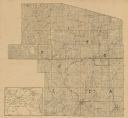
| Description: | This 1902 map of the eastern portion of Sawyer County, Wisconsin, shows the township and range system, sections, roads, farm houses, camps, school houses, ... |

| Date: | 1953 |
|---|---|
| Description: | This mid 20th century map of Vilas County and northeastern Oneida County, Wisconsin, shows the township and range grid, sections, cities and villages, rail... |

| Date: | 1890 |
|---|---|
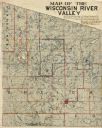
| Description: | Shows vacant state land, government land, townships, and selected farms, camps, saw mills, etc. in Vilas and Oneida Counties, and part of Iron County. "For... |

| Date: | 07 10 1967 |
|---|---|
| Description: | Two women and several children are sitting in a low-walled enclosure filled with hay. In the background is a barn. |

| Date: | 05 23 1935 |
|---|---|
| Description: | One of two images under the headline: "Lining Up to Draw for Location of Farms in Alaska." Original caption reads: "A serious business — these members of t... |

| Date: | 05 23 1935 |
|---|---|
| Description: | One of two images under the headline: "Lining Up to Draw for Location of Farms in Alaska." Original caption reads: "A serious business — these members of t... |
If you didn't find the material you searched for, our Library Reference Staff can help.
Call our reference desk at 608-264-6535 or email us at: