| Date: | |
|---|---|
| Description: | Campers watch Native American ceremonies while seated around the council ring at Camp St. John. The group of boys and young men gather around a fire pit, a... |

| Date: | 1630 |
|---|---|
| Description: | One of the few maps by Dutch cartographer Willem Blaeu depicting the Americas, this map shows regions, settlements, islands, mountains, forests, rivers, an... |

| Date: | 1720 |
|---|---|
| Description: | Detailed, ornate, and comprehensive map of America from the east coast to present day Texas. Numerous features appear throughout the map, including Native ... |

| Date: | 1667 |
|---|---|
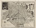
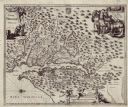
| Description: | Map of Virginia depicting the discoveries detailed by John Smith in his exploration of the region. It shows Jamestown, Native American tribes and villages,... |

| Date: | 1671 |
|---|---|
| Description: | Map of Virginia depicting the discoveries detailed by John Smith in his exploration of the region. It shows Jamestown, Native American tribes and villages,... |

| Date: | 1911 |
|---|---|
| Description: | Indian women paddle their canoes on Rainy Lake. Other people and dogs are on the shore. |

| Date: | |
|---|---|
| Description: | Stereograph of a Chippewa (Ojibwa) woman sitting in the open doorway of a wigwam. She is wearing a dark skirt and patterned blouse. The foreground is cover... |
If you didn't find the material you searched for, our Library Reference Staff can help.
Call our reference desk at 608-264-6535 or email us at: