| Date: | 1929 |
|---|---|
| Description: | A group of men play golf at an International Harvester employee picnic. There are women and children watching the group. |

| Date: | 1929 |
|---|---|
| Description: | A group of male golfers are sitting and standing while posing for a portrait at an International Harvester employee picnic. |

| Date: | 1930 |
|---|---|
| Description: | The back of the pictorial map titled Recreational Map of Glacier National Park, Montana: Waterton Lakes National Park, Alberta. 14 panels of text and photo... |

| Date: | 1990 |
|---|---|
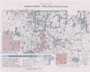
| Description: | This map shows various types of trails, boat landings, canoe areas, public beaches, picnic areas, campgrounds, golf courses, public tennis courts, and othe... |

| Date: | 1970 |
|---|---|
| Description: | This map shows roads, parks, swimming beaches, golf courses, yacht harbors, light houses, airports, public hunting grounds, waysides, schools, and fishing ... |

| Date: | 1987 |
|---|---|
| Description: | This map shows federal highways, state or county highways, rivers, lakes, town roads, township boundaries, county boundaries, national or state forest, loo... |
If you didn't find the material you searched for, our Library Reference Staff can help.
Call our reference desk at 608-264-6535 or email us at: