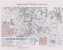
| Date: | 1936 |
|---|---|
| Description: | This pictorial tourist map from the Wisconsin Conservation Commission depicts vacation activities and identifies tourist destinations throughout the state.... |

| Date: | 1975 |
|---|---|
| Description: | A tourist map of Grant County that displays the various activities and attractions found in the cities throughout the county, such as boat landings, fishin... |

| Date: | 1987 |
|---|---|
| Description: | This map shows federal highways, state or county highways, rivers, lakes, town roads, township boundaries, county boundaries, national or state forest, loo... |

| Date: | |
|---|---|
| Description: | A man and woman are on the putting green of a golf course, with a golf cart in the foreground on the right, and in the background a view of the bay. The wo... |

| Date: | 1969 |
|---|---|
| Description: | A woman getting ready to putt on the green at the Peninsula State Park Golf Course. A man stands on the left watching, and parked behind him is a golf cart... |

| Date: | 1935 |
|---|---|
| Description: | View down hill towards six men enjoying an elevated view of the golf course at Devil's Lake State Park. One of the men is sitting under the porch of the br... |

| Date: | 1940 |
|---|---|
| Description: | View down hill towards a man and a woman posing in the act of putting on a green of the golf course in Peninsula State Park. Eagle Harbor and the village o... |
If you didn't find the material you searched for, our Library Reference Staff can help.
Call our reference desk at 608-264-6535 or email us at: