| Date: | 1872 |
|---|---|
| Description: | Map of the Chippewa River, from the head of navigation at the city of Chippewa Falls, covering a distance of 16 miles above : showing the established impro... |

| Date: | |
|---|---|
| Description: | A patrol officer looks at his compass as he smokes a cigarette. |

| Date: | 07 1942 |
|---|---|
| Description: | A patrol officer from the 14th Infantry, based in Fort Davis, Panama, follows his compass through the jungle. The patrol officer has a small cigarette in o... |

| Date: | 1901 |
|---|---|
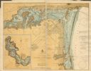
| Description: | This map shows streets, industrial buildings, a portion of Lake Superior and other lakes, bays, and rivers in portions of Duluth and Superior. Relief is sh... |

| Date: | 1782 |
|---|---|
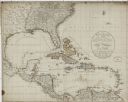
| Description: | Map of the West Indies and south eastern North America, remarkably detailed, showing cities, mountains, rivers, lakes, mines, plantations, forts, banks, an... |
If you didn't find the material you searched for, our Library Reference Staff can help.
Call our reference desk at 608-264-6535 or email us at: