 Filter: Subject of piers
Filter: Subject of railroads
Filter: Subject of piers
Filter: Subject of railroads

| Date: | 1886 |
|---|---|
| Description: | Bird's-eye view of Ashland, on the shores of Lake Superior, with insets of The Apostle Islands Chequamagon Bay & Ashland, and Distances from Ashland. |

| Date: | 1856 |
|---|---|
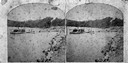
| Description: | View looking west from Lake Michigan with several steam ships and sailing vessels in harbor. There is a lighthouse to left of center, along shoreline. |

| Date: | 1883 |
|---|---|
| Description: | Bird's-eye map of Superior, county seat of Douglas County, on the shores of Lake Superior, with insets of points of interest. |

| Date: | 1913 |
|---|---|
| Description: | Bird's-eye map of Superior. "The New Steel Center." |

| Date: | 1915 |
|---|---|
| Description: | Bird's-eye view of Superior, Wisconsin, and Duluth, Minnesota on opposite shore of Lake Superior. |

| Date: | 1886 |
|---|---|
| Description: | Bird's-eye map of Washburn on Lake Superior. There is an inset of Washburn, Chequamagon and the Apostle Islands. |

| Date: | 1879 |
|---|---|
| Description: | Bird's-eye map of Two Rivers. |

| Date: | 1896 |
|---|---|
| Description: | Bird's-eye view of Washburn, with twenty vignettes around side, water in foreground with docks and lumber corral. Thirty-three locations identified in key ... |

| Date: | 1885 |
|---|---|
| Description: | Ore dock of the Milwaukee, Lake Shore, and Western Railroad, with a pile of logs in the foreground and docked ships in the background. |

| Date: | 1892 |
|---|---|
| Description: | Bird's-eye view of Chicago, with ships in the Lake Michigan harbor. |
| Date: | 1874 |
|---|---|
| Description: | View west from the Cliff House at Devil's Lake. |

| Date: | 1920 |
|---|---|
| Description: | Caption reads: "Mammoth Ore Docks, Ashland, Wis." A building and roads are in the foreground. Several ore ships can be seen. |
| Date: | 1899 |
|---|---|
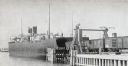
| Description: | Chicago, St. Paul, Minneapolis & Omaha train cars loading onto car ferry Pere Marquette. |

| Date: | 1902 |
|---|---|
| Description: | Two panoramic bird's-eye views of the Paine Lumber Company, including the general plant, sawmill, and lumber yards. Heading at the top says: Home of Wiscon... |

| Date: | 1905 |
|---|---|
| Description: | This early 20th century map of Door County, Wisconsin, shows the township and range grid, towns, sections, cities and villages, landownership and acreages,... |

| Date: | 1861 |
|---|---|
| Description: | This map shows lot and block numbers, piers, streets, monuments, and township section corners. Included is a note on the width of avenues, piers, slips, al... |

| Date: | 06 1923 |
|---|---|
| Description: | Sanborn map of Ashland, which includes Chequamegon Bay. |

| Date: | 1902 |
|---|---|
| Description: | This map is a chart of Milwaukee Harbor that displays local streets, bridges, roads, railroads, public buildings, businesses, factories, dry docks, parks, ... |
If you didn't find the material you searched for, our Library Reference Staff can help.
Call our reference desk at 608-264-6535 or email us at:

