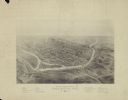
| Date: | 1896 |
|---|---|
| Description: | Bird's-eye map of Darlington. Area bordered by Washington and North Streets, upper left hand corner, the fairgrounds, upper right corner, River Street, bot... |

| Date: | 1883 |
|---|---|
| Description: | Bird's-eye map of Prairie du Sac, Wisconsin with an inset of Clifton. |

| Date: | 1891 |
|---|---|
| Description: | Bird's-eye map of Stevens Point, looking east, with an inset of the Water Works. Wisconsin River in foreground with fifty-three business locations identifi... |

| Date: | 1879 |
|---|---|
| Description: | Bird's-eye map of Two Rivers. |

| Date: | |
|---|---|
| Description: | A man in motion moves upon good reason. To create disorder he must stop and settle down. |

| Date: | |
|---|---|
| Description: | View down a long dirt road. In the distance the road passes under a railroad bridge near a church with a cemetery. Caption reads: "Lover's Lane, Mapleton, ... |

| Date: | 1922 |
|---|---|
| Description: | Text on front reads: "Eighth Street Bridge, Sheboygan, Wis." A pedestrian, car and railroad bridge across the Sheboygan River. A bicyclist is coming across... |
If you didn't find the material you searched for, our Library Reference Staff can help.
Call our reference desk at 608-264-6535 or email us at: