| Date: | 07 10 1949 |
|---|---|
| Description: | Aerial view of Minocqua showing the surrounding lakes. |

| Date: | 1877 |
|---|---|
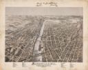
| Description: | Bird's-eye map of Janesville on the Rock River. |

| Date: | 1893 |
|---|---|
| Description: | Bird's-eye map of Jefferson, looking north. Crayfish River at left and center, Rock River from upper center to bottom center, joins at left of center; thir... |

| Date: | |
|---|---|
| Description: | Elevated general view of the city with harbor and mountains. A ship is docked near the railroad bridge. |

| Date: | 09 1884 |
|---|---|
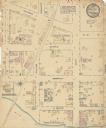
| Description: | Sanborn map of Fort Atkinson including Barrie, Germany, and North Water Streets. |

| Date: | 1905 |
|---|---|
| Description: | View across water towards a powerhouse among very high water on the Black River. Identified as the second power house with high water in 1905. |

| Date: | |
|---|---|
| Description: | Elevated panoramic view of the city of Madison, with the Wisconsin State Capitol and Lake Monona on the far left, and Picnic Point and Lake Mendota on the ... |
If you didn't find the material you searched for, our Library Reference Staff can help.
Call our reference desk at 608-264-6535 or email us at: