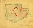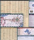
| Date: | 1955 |
|---|---|
| Description: | Bottom of the map reads: "PARKING AREA STUDY MILWAUKEE COUNTY ZOOLOGICAL GARDEN SCALE 1"=200" APRIL 21, 1955 TOTAL PARKING AREA - 3736 CARS 31.1 acres". Th... |

| Date: | 1954 |
|---|---|
| Description: | This map of La Crosse shows residential, multiple dwelling, local business, commercial, light industrial, heavy industrial and special multiple dwelling la... |

| Date: | 1915 |
|---|---|
| Description: | This map shows a plat of city, wards, sections, land ownership by name, local streets, roads, railroads, local businesses, schools, and parks. This map is ... |

| Date: | 1964 |
|---|---|
| Description: | This map is a hand-colored blue line print and shows 4 residence zones, 2 business zones, 1 light manufacturing zones, schools, and parks. The zones are ou... |

| Date: | 1956 |
|---|---|
| Description: | Intended for tourists, this brochure features a map of Milwaukee's central business district as well as general information about parking, beaches and othe... |

| Date: | 1968 |
|---|---|
| Description: | Three maps that show local streets, roads, railroads, parks, country clubs, the University of Wisconsin, Shorewood Hills, Maple Bluff, Monona, Truax Field,... |

| Date: | 2004 |
|---|---|
| Description: | This map shows ATMs, houses of worship, hotels, parking ramps, public parking, union cab stands, bus stops, business district, parks and public areas, gove... |
If you didn't find the material you searched for, our Library Reference Staff can help.
Call our reference desk at 608-264-6535 or email us at: