 Filter: Subject of resorts
Filter: Subject of tourism
Filter: Subject of resorts
Filter: Subject of tourism
| Date: | |
|---|---|
| Description: | Texaco station, with an automobile parked next to the a stone building which has two pumps, at Restwood Cabins. Cabins surround the station, and there is a... |

| Date: | |
|---|---|
| Description: | Exterior view through trees of the main lodge at Trout Lake Resort. A driveway is in front of the entrance which has a half-circular window above the door. |

| Date: | |
|---|---|
| Description: | Exterior view of a small guest cottage, with a small screened-in porch, at Trout Lake Resort set amongst the trees. |

| Date: | |
|---|---|
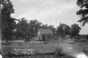
| Description: | View of a row of cabins on the right. A drive leads to the main building of Van Hill Modern Cabins in the background on the left. |

| Date: | |
|---|---|
| Description: | Exterior view of a guest cabin called "The Tavern" at Van Hill Modern Cabins. A stone chimney is on the right, and the open porch has an arched roof and lo... |
| Date: | 1927 |
|---|---|
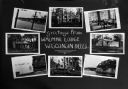
| Description: | Photographic postcard with views of Walmar Lodge, with two cottages and the Wisconsin River as seen from the lodge. Caption reads: "Greetings from Walmar L... |

| Date: | |
|---|---|
| Description: | View from road of row of cabins with chairs on the lawn in front. There is an automobile parked behind the first cabin. |

| Date: | |
|---|---|
| Description: | View from street of the Shell Station at Wee Hoose. |

| Date: | |
|---|---|
| Description: | View across road of the cottages at the White House Hotel, with an information kiosk along the sidewalk between them. A group of people are in front of the... |

| Date: | 1931 |
|---|---|
| Description: | View of a row of cottages on the left side along a sidewalk. The property is bordered by white picket fences. There is a row of stones in front along edge ... |

| Date: | 1931 |
|---|---|
| Description: | View from road of the guest cottages on both sides of the lawn. The property is bordered by white picket fences, and there is a row of stones in front alon... |

| Date: | |
|---|---|
| Description: | View across sidewalk of the courtyard of the White House Hotel. The Annex is on the right. A gazebo is on the left, there are benches and a lawn swing in t... |

| Date: | 1926 |
|---|---|
| Description: | This brochure was intended for tourists and shows resorts, lakes and railroads in northwestern Wisconsin and part of Michigan’s upper peninsula. Also inclu... |

| Date: | 1939 |
|---|---|
| Description: | This brochure was intended for tourists and shows resorts, lakes and railroads in northwestern Wisconsin and part of Michigan’s upper peninsula. Also inclu... |

| Date: | 1969 |
|---|---|
| Description: | This map shows ski areas, resorts, camps, special areas, airports, and roads. The map covers Vilas and Oneida counties and parts of Iron, Price, Lincoln, L... |

| Date: | 1961 |
|---|---|
| Description: | This map shows the lake, clubs, resorts, motels, school house, public approaches, and public parks. The back of map includes advertisements and text. |

| Date: | 1969 |
|---|---|
| Description: | This map shows businesses, resorts, roads, public boat landings, schools, cemeteries, and location of fish and game. An inset map reads: Continuation along... |

| Date: | 1960 |
|---|---|
| Description: | This map shows public boat ramps, parks, highways, beaches, bluffs, Green Bay, Garrett Bay, Europe Bay and Lake, Rowley's Bay and Ellison Bay. The map incl... |

| Date: | 1935 |
|---|---|
| Description: | This blue lined map shows the major roads and cities of Wisconsin. The map includes an index, hotel and cafe advertisements, as well as advertisements for ... |

| Date: | 1935 |
|---|---|
| Description: | This blue lined map ("compliments of Black Eagle Oil Company") shows the major roads and cities of Wisconsin. The map includes an index, hotel and cafe adv... |
If you didn't find the material you searched for, our Library Reference Staff can help.
Call our reference desk at 608-264-6535 or email us at: