 Filter: Subject of transportation
Filter: Creator Name of Journal Company
Filter: Subject of transportation
Filter: Creator Name of Journal Company
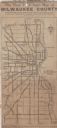
| Date: | 1923 |
|---|---|
| Description: | This map shows state, county, and city roadways as well as neighborhoods. Lake Michigan is on the far right. |

| Date: | 1929 |
|---|---|
| Description: | This map of the entire state includes portions of Illinois, Iowa, Michigan, and Minnesota. The map shows U.S., state, and county highways, roads, campsites... |
If you didn't find the material you searched for, our Library Reference Staff can help.
Call our reference desk at 608-264-6535 or email us at: