Filter: Subject of wisconsin river (wis.)
Filter: Subject of express highways
Filter: Subject of wisconsin river (wis.)
Filter: Subject of express highways

| Date: | 05 16 1994 |
|---|---|
| Description: | The front side of this map shows roads, highways, the Wisconsin River, Stevens Point Airport, and surrounding towns. A street index is included along the r... |

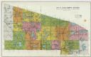
| Date: | 1906 |
|---|---|
| Description: | This map shows the cities, counties (outlined in yellow and labeled), rivers, lakes, and the major highways and freeways of Wisconsin and parts of the surr... |

| Date: | 1935 |
|---|---|
| Description: | This road map shows automobile routes across the state of Wisconsin. Advertisements for various hotels are featured along the bottom edge of the map, while... |

| Date: | 10 1961 |
|---|---|
| Description: | View from hill towards cars driving over a bridge spanning the Wisconsin River (I90/I94/I39). |
If you didn't find the material you searched for, our Library Reference Staff can help.
Call our reference desk at 608-264-6535 or email us at: