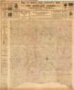
| Date: | 1903 |
|---|---|
| Description: | This map of Richland County, Wisconsin, shows land ownership and acreages, the township and range grid, sections, cities, towns and post offices, roads, ra... |

| Date: | 1900 |
|---|---|
| Description: | This map of Adams County, Wisconsin, from E.B. Foote's Plat book of Adams County, Wisconsin, 1900, shows the township and range grid, towns, sections, citi... |

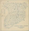
| Date: | 1911 |
|---|---|
| Description: | Blue line print. Shows post offices, houses, schools, churches, roads, routes, rivers, and railroads. Includes explanation of symbols. "H.G.M. October 12,... |

| Date: | 1900 |
|---|---|
| Description: | This map shows landownership, railroads, roads, churches, schools, cemeteries, post offices, townships, city wards, Lake Michigan, and rivers. The map incl... |

| Date: | |
|---|---|
| Description: | Elevated view of the Grand Avenue Bridge. A horse and wagon is coming across the bridge, and pedestrians are crossing on the walkway. There is a post offic... |

| Date: | 1901 |
|---|---|
| Description: | A plat map of Marathon county, township 29, north range, 8 east. |
If you didn't find the material you searched for, our Library Reference Staff can help.
Call our reference desk at 608-264-6535 or email us at: