 Filter: Year of 1800-1899
Filter: Creator Name of Lapham, Increase Allen
Filter: Year of 1840-1849
Filter: Year of 1800-1899
Filter: Creator Name of Lapham, Increase Allen
Filter: Year of 1840-1849
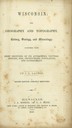
| Date: | 1846 |
|---|---|
| Description: | Title page of the book "Wisconsin: Geography and Topography". |

| Date: | 1849 |
|---|---|
| Description: | Pencil sketch of a cross-section of the Dells of the Wisconsin River. People are in a row boat in the center. Caption at bottom: "The Dells — Wisconsin Riv... |

| Date: | 1842 |
|---|---|
| Description: | This map shows portions of northern Illinois and Wisconsin surveyed by the map's creation. It shows county lines and university land, and depicts lead and ... |

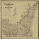
| Date: | 1846 |
|---|---|
| Description: | This map shows the counties and towns in existence at the time as well as lead and copper mines. |

| Date: | 1848 |
|---|---|
| Description: | This map by Increase Lapham shows the township and range system in southern and eastern Wisconsin as well as along the Wisconsin River in present-day Marat... |
| Date: | 1848 |
|---|---|
| Description: | This map shows the township and range system in southern and eastern Wisconsin as well as along the Wisconsin River in present-day Marathon, Portage, and W... |

| Date: | 1849 |
|---|---|
| Description: | Published a year after Wisconsin entered statehood, this map shows the counties and towns in existence at the time - mainly in southern/southeastern Wiscon... |

| Date: | 1840 |
|---|---|
| Description: | An ink, watercolor, and pencil on tracing paper, hand-drawn map of Milwaukee County, Wisconsin that shows the town and range system, sections, lakes and st... |

| Date: | 1844 |
|---|---|
| Description: | An ink on paper, hand-drawn map of Milwaukee County that shows the sectioning of townships, the boundary of the canal grant, roads, streams, lakes, includi... |

| Date: | 1849 |
|---|---|
| Description: | A hand-drawn map of showing the two proposed routes from the Milwaukee River to the Moody’s Lime Quarry at Milwaukee, Wisconsin. The map includes the route... |

| Date: | 1840 |
|---|---|
| Description: | This manuscript map by Increase Lapham shows the railroads, roads, wetlands, lakes and streams, dams, prairies, and settlers in the eastern half of Waukesh... |

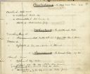
| Date: | 1849 |
|---|---|
| Description: | Handwritten list of plants in the Ranunculaceae or crowfoot family. |
| Date: | 1845 |
|---|---|
| Description: | Page from Increase Lapham's 1845 list of plants of Wisconsin including Oxalidaceae, Zanthoxylaceae, and Anacardiaceae and notations of where and when indiv... |

| Date: | 1840 |
|---|---|
| Description: | Map shows three Wisconsin territories, Jefferson, Waukesha, and Milwaukee. Map is ink, pencil, and watercolor on paper. Relief shown by hachures. |

| Date: | 1844 |
|---|---|
| Description: | Increase Lapham's handwritten title page for A Geographical and Topographical Description of Wisconsin |

| Date: | 1844 |
|---|---|
| Description: | Handwritten first page of Increase Lapham's unpublished gazetteer of Wisconsin. |

| Date: | 1844 |
|---|---|
| Description: | Handwritten page from Increase Lapham's unpublished gazetteer of Wisconsin. The page includes entries for Choaking Creek, Cincinnati, City of the Four Lak... |
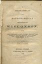
| Date: | 1844 |
|---|---|
| Description: | Title page of Increase Lapham's A Geographical and Topographical Description of Wisconsin published by P.C. Hale of Milwaukee, Wisconsin. |

| Date: | 1846 |
|---|---|
| Description: | This map shows lot and block numbers, roads, railroads, and some landowners’ names and includes the manuscript annotations: "From the Lapham collection" --... |
If you didn't find the material you searched for, our Library Reference Staff can help.
Call our reference desk at 608-264-6535 or email us at:
