| Date: | 1873 |
|---|---|
| Description: | A hand-colored, geological map of the Fox and Wisconsin rivers’ water path from the Mississippi River to the Great Lakes. The map also shows those railroad... |

| Date: | 1874 |
|---|---|
| Description: | This map of Wisconsin shows cities, counties, railroads already completed and railroads projected, and geological makeup of the land such as lakes. |

| Date: | 1875 |
|---|---|
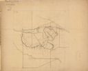
| Description: | This manuscript map by Increase Lapham, drawn in the last year of his life, shows landownership, roads and railroads, springs, and boat houses around Ocono... |

| Date: | 07 1870 |
|---|---|
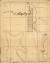
| Description: | This map of Ironton is pen-and-ink on paper and shows lots and block numbers, mill, foundry buildings, limestone quarry, iron mine, and roads. Relief is sh... |
If you didn't find the material you searched for, our Library Reference Staff can help.
Call our reference desk at 608-264-6535 or email us at: