 Filter: Year of 1900-1999
Filter: Creator Name of Rosholt, Malcolm Leviatt
Filter: Year of 1900-1999
Filter: Creator Name of Rosholt, Malcolm Leviatt
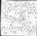
| Date: | 1971 |
|---|---|
| Description: | This map is a photocopy of a plat created in 1966 by Malcolm Rosholt which shows the community as it appeared in 1856. The map includes land owned by Norwe... |
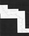
| Date: | 1971 |
|---|---|
| Description: | This map shows major tributaries, and also covers parts of Marathon and Portage Counties. |
If you didn't find the material you searched for, our Library Reference Staff can help.
Call our reference desk at 608-264-6535 or email us at: