Search: Grant
Search: County
Filter: Categories of Wisconsin Historical Images
Filter: Year of 1900-1999
Search: Grant
Search: County
Filter: Categories of Wisconsin Historical Images
Filter: Year of 1900-1999
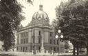
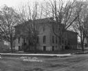
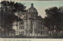
| Date: | 1925 |
|---|---|
| Description: | Exterior view of the Grant County Court House. Caption reads: "Court House, Lancaster, Wis." |
| Date: | 1909 |
|---|---|
| Description: | "The First Civil War Monument" outside the Grant County Courthouse. The monument is dedicated "to the memory of the brave soldiers of Grant County who fell... |
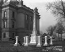
| Date: | 1913 |
|---|---|
| Description: | Corner view of the Grant County courthouse. The Soldiers' Monument and a fountain are in the foreground. A gazebo is under the trees on the right. Caption ... |

| Date: | 1975 |
|---|---|
| Description: | A tourist map of Grant County that displays the various activities and attractions found in the cities throughout the county, such as boat landings, fishin... |
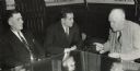
| Date: | 09 04 1943 |
|---|---|
| Description: | Governor Goodland conferring with District Attorney John Grindell and Sheriff Aloys Klaas about gambling in Grant County. |
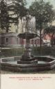
| Date: | 1906 |
|---|---|
| Description: | Hand-colored postcard of the Memorial Fountain, with the Grant County Courthouse in the background. Caption reads: "Memorial Fountain erected May 30, 1906,... |
| Date: | 08 23 1946 |
|---|---|
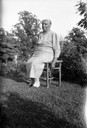
| Description: | Aunt Lily Richmond sang African American spirituals for song collector Helene Stratman-Thomas. Richmond came to Grant County Wisconsin with her parents, fr... |
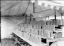
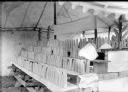
| Date: | 09 17 1912 |
|---|---|
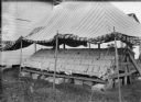
| Description: | Boys and Girls Wisconsin No. 7 Corn Exhibit. J.J. Garland of Madison judged the exhibit. |
| Date: | 06 30 1955 |
|---|---|
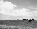
| Description: | From caption: "Prairie two miles north of Montfort Wis on the Iowa-Grant County line trunk highway I view to the east from the road. Photo by Robert Hall 1... |

| Date: | 1944 |
|---|---|
| Description: | Portage County Map. Includes the towns of Eau Plaine, Dewey, Sharon, Alban, Carson, Hull, New Hope, Linwood, Stockton, Amherst, Plover, Grant, Buena Vista,... |

| Date: | 1918 |
|---|---|
| Description: | Page from the Standard Atlas of Grant County, Wisconsin of Part of Townships 5 and 6 North, Range 5 West of the 4th P.M. |

| Date: | 1942 |
|---|---|
| Description: | This map shows a paper city laid out in 1836 on the Wisconsin River, now the site of Wyalusing State Park, Grant County. The upper right corner includes a ... |

| Date: | 1920 |
|---|---|
| Description: | This 1920 map actually depicts present-day Wyalusing State Park at the confluence of the Mississippi and Wisconsin rivers in the Town of Wyalusing, Grant C... |
| Date: | 05 06 1910 |
|---|---|
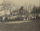
| Description: | Large group of children and adults pose outdoors at the second annual contest. |
| Date: | 05 02 1913 |
|---|---|
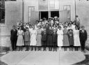
| Description: | Group of children pose in doorway of brick building. |
| Date: | 05 07 1909 |
|---|---|
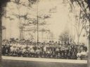
| Description: | Large group of school children and adults posed outside. Some of the students are holding banners. |

| Date: | 1910 |
|---|---|
| Description: | This map shows the Wisconsin Central Railroad land grant lands owned and for sale by the Soo Line in Taylor County, Wisconsin, as well as in southwestern L... |
If you didn't find the material you searched for, our Library Reference Staff can help.
Call our reference desk at 608-264-6535 or email us at: