Search: Lead
Filter: Categories of Wisconsin Historical Images
Search: Lead
Filter: Categories of Wisconsin Historical Images
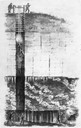
| Date: | 1844 |
|---|---|
| Description: | Cross section drawing of a Wisconsin lead mine. |
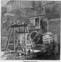
| Date: | 05 1866 |
|---|---|
| Description: | Engraved view of two men in a train locomotive observing the weighing of pig lead. Several bars of lead are stacked near the scale. |

| Date: | 1829 |
|---|---|
| Description: | Photoprint of Crawford County lead district map. |

| Date: | 1829 |
|---|---|
| Description: | Map of lead mines operating in Wisconsin. |
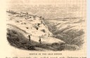
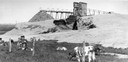
| Date: | 1853 |
|---|---|
| Description: | Engraved view of miners and hillside mines in the Lead Region. Caption reads: "Sketch of the Lead Region." |
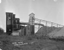
| Date: | 1850 |
|---|---|
| Description: | Blast furnace, also known as a Scotch hearth used in lead mining. |
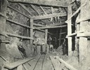
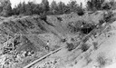
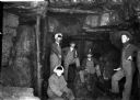
| Date: | 1930 |
|---|---|
| Description: | View inside a lead mine showing six miners with a car on a track. |
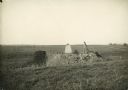
| Date: | 06 1949 |
|---|---|
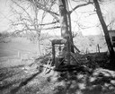
| Description: | Gophering, or prospecting for lead using a windlass at Maplewood Farm. |
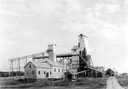
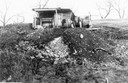
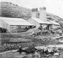
| Date: | 1920 |
|---|---|
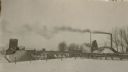
| Description: | The Empire zinc and lead mine. Very litle lead is now produced. |

| Date: | |
|---|---|
| Description: | Soon after the turn of the century, Joplin was named the lead and zinc capital of the world, producing 23 million dollars in lead and zinc between the year... |
| Date: | |
|---|---|
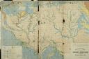
| Description: | Geological Map of the lead regions in Wisconsin, Illinois and Iowa. |

| Date: | 1920 |
|---|---|
| Description: | An ink on tracing paper, hand-drawn map that shows lead mines, the boundary of the lead bearing strata, and the military road in Lafayette, Grant, Iowa, an... |
If you didn't find the material you searched for, our Library Reference Staff can help.
Call our reference desk at 608-264-6535 or email us at: