 Search: Lead
Filter: Subject of dwellings
Search: Lead
Filter: Subject of dwellings
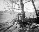
| Date: | 06 1949 |
|---|---|
| Description: | Gophering, or prospecting for lead using a windlass at Maplewood Farm. |
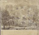
| Date: | 1845 |
|---|---|
| Description: | Drawing of Shullsburg. Text at bottom reads: "Smelting lead ore in log furnaces. Scene in Gratiots Grove at Shullsburg, Wis. in 1845-6. Drawn from life. By... |
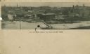
| Date: | |
|---|---|
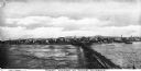
| Description: | Aerial panoramic view of central Mayville over a frozen river. Caption reads: "All Roads Lead to Mayville, Wis." |
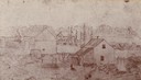
| Date: | 1870 |
|---|---|
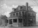
| Description: | Martin H. Meyer's birthplace. Reproduced from a lead pencil sketch made in 1870. |

| Date: | 1955 |
|---|---|
| Description: | View of the fork in the Krueger's driveway. To the left the road leads to the Krueger home, with a truck parked in front. The fork to the right leads to th... |

| Date: | 1925 |
|---|---|
| Description: | A view of Tenpin Alley (rear) active in lead mining days. |
| Date: | 1925 |
|---|---|
| Description: | A view of the front of Tenpin Alley, active in lead mining days. |

| Date: | |
|---|---|
| Description: | The Cobbossee Colony (Camp?) Boardwalk leads past multiple log cottages in a wooded area. |
| Date: | 1910 |
|---|---|
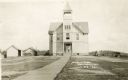
| Description: | Front entrance to the public school in Butternut. A wooden sidewalk leads up to the entrance, where a |
| Date: | 1900 |
|---|---|
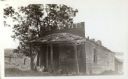
| Description: | View of the Gratiot homestead at Gratiot's Grove Site. |

| Date: | |
|---|---|
| Description: | A man sits outside his home on First Avenue. A path leads through the garden to the front door. |
| Date: | 1920 |
|---|---|
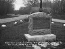
| Description: | A stone monument dedicated to the Old Lead Road. The marker reads: "The Old Lead Road. In 1828, ox-teams, guided along an ancient Winnebago Indian Trail, b... |
| Date: | |
|---|---|
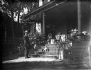
| Description: | Albert Zimmerman and his dog at the front steps that lead to the porch of his house at 746 East Gorham Street. |
| Date: | |
|---|---|
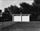
| Description: | A path leads up to large multi-stall outhouse or public bathroom, which stands alone in a grassy field in front of some trees. |
| Date: | |
|---|---|
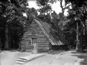
| Description: | A view of a Continental Army hut in a wooded area. A set of steps lead to the front door. |
| Date: | |
|---|---|
| Description: | View of First Wharf from the Bering Sea. A railroad bridge leads to the shoreline. |
| Date: | |
|---|---|
| Description: | Exterior view toward the People's Co-operative Hospital. Stairs lead to the main entrance which has a porch with a sign above it. |

| Date: | |
|---|---|
| Description: | Elevated view from rocks overlooking a valley toward Devil's Lake. Several houses are near a road that leads to the shoreline. |

| Date: | |
|---|---|
| Description: | Exterior of Ward Public School. The sidewalk leads to an entrance where a sign reads: "Public School." |

| Date: | |
|---|---|
| Description: | View of the city and glacier as seen from Port Valdez. A pier leads to the city's shore. |
If you didn't find the material you searched for, our Library Reference Staff can help.
Call our reference desk at 608-264-6535 or email us at: