| Date: | 1978 |
|---|---|
| Description: | Bird’s-eye view map. Shows Madison from the edge of Lake Monona stretching west. Above the map are clouds and in the distance is the edge of the world and ... |

| Date: | 1908 |
|---|---|
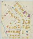
| Description: | Sanborn map of Madison, including West Gilman and Langdon Streets. |

| Date: | 1930 |
|---|---|
| Description: | Lower left hand corner reads: "Compliment of the Madison Association of Commerce MADISON The Four Lake City WISCONSIN." Around the perimeter of the map is ... |

| Date: | 1902 |
|---|---|
| Description: | Madison Sanborn map, including Langdon and State Streets. |

| Date: | 1942 |
|---|---|
| Description: | A detail of a Madison Sanborn map, including Lakelawn Place. |

| Date: | 1920 |
|---|---|
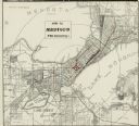
| Description: | A map of Madison and the vicinity. Red lines show the street railway. |

| Date: | 08 1902 |
|---|---|
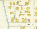
| Description: | A detail of a Madison Sanborn map showing Mendota Court. |

| Date: | 1930 |
|---|---|
| Description: | Indexed map of Madison. Streets, lakes, and points of interest are labelled. Around the edges of the map are the indexed street names. |

| Date: | 1908 |
|---|---|
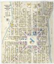
| Description: | A Sanborn map of the isthmus, which includes the map key. |

| Date: | 1908 |
|---|---|
| Description: | A Sanborn map featuring the Capitol Square and surrounding business district. |

| Date: | 1908 |
|---|---|
| Description: | A Sanborn map including a portion of the East Johnson Street and East Gorham Street neighborhood. |

| Date: | 1924 |
|---|---|
| Description: | Intended for tourists, this brochure, titled: "Plan Now to See Madison, The Four Lake City: "The City Built on an Isthmus," features a map of Madison and s... |

| Date: | 1942 |
|---|---|
| Description: | Detail of a Madison Sanborn Map showing the Lake Mendota shoreline. The area shown is between the Blackhawk Country Club and Eagle Heights Woods. |

| Date: | 1907 |
|---|---|
| Description: | This manuscript blueprint map shows land parcels pertaining to University Heights region in Madison, Wisconsin. Streets labeled included, University Avenue... |

| Date: | 1910 |
|---|---|
| Description: | This blueprint plat map shows the plan of lots and streets on a Madison hill south of Lake Monona. Includes annotations showing land prices in pencil. |

| Date: | 1937 |
|---|---|
| Description: | Includes points of interests in Madison and on the University of Wisconsin-Madison campus. Includes list of presidents of University of Wisconsin, 1849-193... |

| Date: | 1920 |
|---|---|
| Description: | Map of the Nakoma neighborhood including the proposed golf grounds. |

| Date: | 1967 |
|---|---|
| Description: | Shows projects and proposed projects, some zoning districts, public housing sites (Project Wis.-3-183-4), streets, and proposed streets. Upper left hand co... |
If you didn't find the material you searched for, our Library Reference Staff can help.
Call our reference desk at 608-264-6535 or email us at: