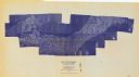
 Search: Madison
Filter: Categories of Wisconsin Historical Images
Filter: Year of 1900-1999
Filter: Subject of human settlements
Filter: Type of Map or Atlas
Search: Madison
Filter: Categories of Wisconsin Historical Images
Filter: Year of 1900-1999
Filter: Subject of human settlements
Filter: Type of Map or Atlas

| Date: | 1908 |
|---|---|
| Description: | A detail of a Madison Sanborn map that includes the University of Wisconsin Boat House, UW Gymnasium & Armory (The Red Gym), fraternity houses, and the YMC... |

| Date: | 1951 |
|---|---|
| Description: | This map shows streets, railroads, Lake Mendota, Lake Monona, Lake Wingra, golf courses, parks, Truax Field, and country clubs. Also included are street, c... |

| Date: | 1920 |
|---|---|
| Description: | This map shows the Nakoma neighborhood in Madison including the "Proposed Golf Ground." The map reads: "Nakoma--the Suburb Superb." The map includes texts ... |

| Date: | 1961 |
|---|---|
| Description: | Shows wards and voting precincts. Published in The Capital times: January 28, 1961. |

| Date: | 1904 |
|---|---|
| Description: | This map shows a plat of the east part of the city, numbered blocks and lots, some landownership, local streets, roads, railroads, wards by number, parks, ... |

| Date: | 1990 |
|---|---|
| Description: | Map of bike routes in Madison. Lower right corner features a system map with legend. Upper left corner is an inset of the Capital Loop with labelled points... |

| Date: | 1905 |
|---|---|
| Description: | This map shows roads, railroads, and location of Keyes Springs, now part of Monona. The map reads: "L.S. Smith, c.e., del. May, 1905" and "For further info... |

| Date: | 1968 |
|---|---|
| Description: | This blue line print map shows proposed changes reserving railroad right-of-ways for future highways, land plots, as well as Lake Monona and Lake Mendota. |

| Date: | 1970 |
|---|---|
| Description: | This photocopy map shows the locations of historic buildings, as well as all other buildings in the isthmus. The map also includes photographs of selected ... |

| Date: | 1904 |
|---|---|
| Description: | This map shows numbered wards and plots, labelled streets, and parks in green. |

| Date: | 1908 |
|---|---|
| Description: | A detail of a Sanborn map showing the North Blair Street area. |
| Date: | 1975 |
|---|---|
| Description: | This bird’s-eye-view map is a series of photographs compiled to show local streets and buildings. |

| Date: | 1966 |
|---|---|
| Description: | This map shows streets, highways, railroads, parks, colleges, cemeteries, county clubs, University of Wisconsin, Truax Field, Middleton, Shorewood Hills, M... |
| Date: | 1925 |
|---|---|
| Description: | Booklet includes maps of Madison, Fond du Lac, Oshkosh, Appleton, Green Bay, Milwaukee, Janesville, Beloit, and La Crosse, Wisconsin and downtown Chicago a... |

| Date: | 1908 |
|---|---|
| Description: | Colored map showing a panoramic view of Madison in great detail. The Wisconsin State Capitol is located at the center, with Lake Mendota in the background ... |

| Date: | 1913 |
|---|---|
| Description: | This map shows city wards and government buildings. The map is oriented with north to upper right. |

| Date: | 1914 |
|---|---|
| Description: | Shows lot numbers and dimensions; covers portion of the neighborhood currently known as Shorewood Hills. Includes red annotations showing houses and sold l... |

| Date: | 1923 |
|---|---|
| Description: | Map showing the parcel of land on the shore of Lake Monona acquired by the City of Madison for a park (today known as Olbrich Park). |

| Date: | 1920 |
|---|---|
| Description: | Shows wards and selected points of interest. Includes street index. Oriented with north to upper right. |

| Date: | 1909 |
|---|---|
| Description: | Streets, Lake Wingra, Lake Mendota, and Lake Monona are all labelled. Map reads: "The present park system of Madison comprises 150 acres of improved parks,... |
If you didn't find the material you searched for, our Library Reference Staff can help.
Call our reference desk at 608-264-6535 or email us at: