 Search: Madison
Filter: Categories of Wisconsin Historical Images
Filter: Year of 1900-1999
Filter: Subject of human settlements
Filter: Type of Map or Atlas
Search: Madison
Filter: Categories of Wisconsin Historical Images
Filter: Year of 1900-1999
Filter: Subject of human settlements
Filter: Type of Map or Atlas

| Date: | 1971 |
|---|---|
| Description: | This map shows streets, highways, railroads, parks, colleges, cemeteries, county clubs, University of Wisconsin, Truax Field, Middleton, Shorewood Hills, M... |

| Date: | 1964 |
|---|---|
| Description: | Indexed map. Street names are to the left, map is to the right. Lakes, streets, highways, and points of interest are labelled. |

| Date: | 1908 |
|---|---|
| Description: | The map reads: "Feb. 3, 1908." Oriented with north to the lower left. Lake Monona, Monona Bay, and Brittingham Park are labelled. |

| Date: | 1941 |
|---|---|
| Description: | A detail of a Sanborn map showing areas at Langdon and Henry Streets, including Lake Lawn Place. |

| Date: | 1960 |
|---|---|
| Description: | This map shows block numbers, tract numbers, tract boundaries, city limits, local streets, railroads, Lake Mendota, and Lake Monona. |

| Date: | 1905 |
|---|---|
| Description: | This blueprint map includes manuscript annotations in red showing land of Home Realty Co., Hon. Geo. B. Burrows, and A.O. Fox Industrial. |

| Date: | 1961 |
|---|---|
| Description: | This street map includes an ancillary map of Dane County highways and a business directory. Lake Mendota, Lake Monona, Monona Bay, Yahara River, and Lake W... |

| Date: | 1918 |
|---|---|
| Description: | This map shows Madison and includes an index of University of Wisconsin buildings, city buildings, and churches. Lake Mendota, Lake Monona, and Lake Wingra... |

| Date: | 1938 |
|---|---|
| Description: | This map is blue line print and shows local streets, roads, the University of Wisconsin, Monona Village, Verona, Middleton, McFarland, Lake Mendota, Lake M... |

| Date: | 1908 |
|---|---|
| Description: | Shows pipes of various sizes, hydrants, valves, and wells. "1907" -- Lower margin. Lake Wingra, Lake Monona, and Lake Mendota are labelled. |

| Date: | 1906 |
|---|---|
| Description: | Hand-drawn topographical map of the Turville Estate. |

| Date: | 1904 |
|---|---|
| Description: | This map shows a plat of the west part of the city, numbered blocks and lots, some landownership, local streets, roads, railroads, wards by number, parks, ... |

| Date: | 1910 |
|---|---|
| Description: | Map of the general plan of the district of the Four Lakes. |

| Date: | 1921 |
|---|---|
| Description: | This map, oriented with north to the upper right, shows roads, railroads, and points of interest. Lake Mendota, Wingra, Monona, Waubesa, Mud, Hook, Island,... |

| Date: | 1903 |
|---|---|
| Description: | Shows lot numbers and dimensions. "Issued May 31, 1903" -- Inscribed in ink. Oriented with north to the upper right. Includes text. Labelled streets are "R... |

| Date: | 10 1911 |
|---|---|
| Description: | This map shows lot numbers, building lines, roads, trees, and Indian mounds. Relief is shown by contours. Includes manuscript annotations marking parks. |

| Date: | 1920 |
|---|---|
| Description: | This hand-colored bird's-eye-view map shows roads, parks, golf club, schools, buildings, landscaping, and part of Lake Wingra. |
| Date: | 1967 |
|---|---|
| Description: | Schematic Master Plan for the City of Madison, Wisconsin. William Wesley Peters, Architect • The Frank Lloyd Wright Foundation. |

| Date: | 1900 |
|---|---|
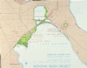
| Description: | A hydrographic map of Lake Monona and the adjacent topography. |

| Date: | 1920 |
|---|---|
| Description: | This bird's-eye-view map shows plat of area, numbered blocks and lots, local streets, roads, parks, golf club, schools, buildings, landscaping, and part of... |
If you didn't find the material you searched for, our Library Reference Staff can help.
Call our reference desk at 608-264-6535 or email us at: