 Search: Madison
Filter: Categories of Wisconsin Historical Images
Filter: Year of 1900-1999
Filter: Subject of human settlements
Filter: Type of Map or Atlas
Filter: Year of 1940-1949
Search: Madison
Filter: Categories of Wisconsin Historical Images
Filter: Year of 1900-1999
Filter: Subject of human settlements
Filter: Type of Map or Atlas
Filter: Year of 1940-1949

| Date: | 1942 |
|---|---|
| Description: | A detail of a Madison Sanborn map, including Lakelawn Place. |

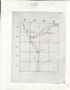
| Date: | 1943 |
|---|---|
| Description: | Shows Madison city limits with thick solid lines and ward districts with dotted lines. The wards are numbered, and points of interests and land marks are l... |

| Date: | 1942 |
|---|---|
| Description: | Detail of a Madison Sanborn Map showing the Lake Mendota shoreline. The area shown is between the Blackhawk Country Club and Eagle Heights Woods. |

| Date: | 1941 |
|---|---|
| Description: | A detail of a Sanborn map showing areas at Langdon and Henry Streets, including Lake Lawn Place. |

| Date: | 1940 |
|---|---|
| Description: | Shows property ownership, store divisions, and bus stops. "Sept. 12, 1940." Oriented with north to the right. Insets: "Trade area" location map and enlarge... |

| Date: | 1949 |
|---|---|
| Description: | Color bird's-eye map of the University of Wisconsin-Madison as it was midcentury, with two co-eds, several photographs of campus landmarks around edges, an... |

| Date: | 1948 |
|---|---|
| Description: | Map created between 1948 and 1954. Shows businesses and lot owners around the State Capitol. Oriented with north to the upper right. Includes "continued in... |

| Date: | 1948 |
|---|---|
| Description: | Colored map with black and white photographic images in wedges at right and left sides. Map extends from Camp Randal stadium at bottom left corner, to Lake... |

| Date: | 06 29 1941 |
|---|---|
| Description: | A map showing the national roots of the people of Wisconsin, based on the ethnic stock research by University of Wisconsin-Madison sociologist Prof. George... |

| Date: | 1942 |
|---|---|
| Description: | This map shows the Wisconsin and Fox River routes in green, and the Milwaukee and Rock River Canal routes in red. Prairie du Chien, Fort Winnebago, Grand C... |
| Date: | 1949 |
|---|---|
| Description: | This map is comprised of six plates that depict the rout the Sauks and Meskwakis, led by Black Hawk, took through Wisconsin during the Black Hawk War of 18... |
If you didn't find the material you searched for, our Library Reference Staff can help.
Call our reference desk at 608-264-6535 or email us at: