| Date: | 1990 |
|---|---|
| Description: | Map of bike routes in Madison. Lower right corner features a system map with legend. Upper left corner is an inset of the Capital Loop with labelled points... |

| Date: | 1998 |
|---|---|
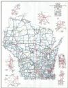
| Description: | This map shows the annual average of daily traffic for 1997. Includes insets of Milwaukee County; Eau Claire and vicinity; Green Bay and vicinity; Appleton... |

| Date: | 1991 |
|---|---|
| Description: | This 1991 map of Burnett County, Wisconsin, shows Governor Knowles State Forest, wildlife areas, public hunting grounds, and other outdoor recreation facil... |

| Date: | 1994 |
|---|---|
| Description: | This brochure presents a series of 16 maps of the Glacial Drumlin Trail and the New Berlin Trail. The Glacial Drumlin Trail consists of 53 miles of bike tr... |

| Date: | 1990 |
|---|---|
| Description: | This tourism brochure of Ashland County, Wisconsin, from the Ashland Area Chamber of Commerce includes a map of the county showing tourist destinations and... |

| Date: | 1996 |
|---|---|
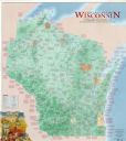
| Description: | This map shows roads, lakes, points of interest including colleges, trails, historic communities and sites, museums, and parks. Also included are descripti... |
If you didn't find the material you searched for, our Library Reference Staff can help.
Call our reference desk at 608-264-6535 or email us at: